Vishoek Traditional Cache
Knagur Green: No CO response
Please note Use of geocaching.com services is subject to the terms and conditions
in our disclaimer.
This is a small cache placed as you come in to fish hoek. It should be a easy park and grab Cache. Take your own pen/pencil.
Please use stealth when retreving and replacing the cache. (please place it back the way you found it.)If you don't retrieve the log book you cannot claim a find.
The local shop owner knows about the cache and has given his permission for the placement.
The Early Days.
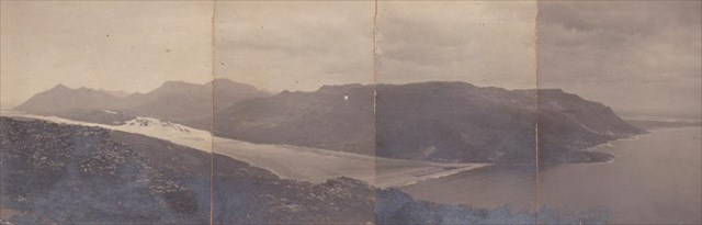
Fish Hoek (Afrikaans: Vishoek, meaning either Fish Corner or Fish Glen) is a coastal town at the eastern end of the Fish Hoek Valley on the False Bay side of the Cape Peninsula in Cape Town, South Africa. Previously a separate municipality, Fish Hoek is now part of the City of Cape Town. As a coastal suburb of Cape Town, Fish Hoek is popular as a residence for commuters, retired people and holidaymakers alike. The traditional industries of 'trek' fishing and angling coexist with the leisure pursuits of surfing, sailing and sunbathing.
The town
After being part of the transitional South Peninsula Municipality from 1996 to 2000, Fish Hoek now falls under the City of Cape Town. Today Fish Hoek is regarded as a suburb of greater Cape Town and lies on the railway line from the central business district of that city to Simon's Town in the south. It is approximately 30 kilometres by road from Fish Hoek to the centre of Cape Town, a journey that can take anything from 30 minutes to two hours, depending on the traffic. Until recently, Fish Hoek was a "dry" area - one of the conditions placed by the owner who gave the land for development was that there be no alcohol sold there. Nowadays, alcohol is available in restaurants and bars but there are no bottle stores. Fish Hoek has become well known as a tourist resort and as a place where elderly people retire. Fish Hoek and its surrounding suburbs are served by the local False Bay Echo newspaper, originally the Fish Hoek Echo, and the Peoples Post. Schools include Fish Hoek Primary, Fish Hoek High School and Paul Greyling Primary.
Fish Hoek beach
The beach is about 1.5 kilometres (0.93 mi) long and quite flat, and the bay is protected from the currents and stronger surf in the rest of False Bay. Swimming is allowed along the entire beach with lifesavers on duty during the summer peak season, and body surfing, boogie boarding, wind surfing and kayaking are popular. The water is far warmer than the Atlantic Seaboard, averaging between just under 17 °C (63 °F) annually (similar to Northern Mediterranean Waters like Monte Carlo or Nice, and peaking at 22 °C (72 °F) in Summer months. Restaurants and children's play areas are situated at the southern end, and a path known as Jager Walk (also spelled Jaeger or Jagger, and known locally as the Cat Walk) runs past rock pools on the southern side of the bay. Shark spotters are often on duty, especially during the summer tourist season. Despite this, there have been two fatal attacks on swimmers in the bay in recent years, one in November 2004 and one in January 2010.[3] On September 28, 2011, a 44 year old man lost part of his leg after being mauled by a Great White shark, despite the beach being closed and shark flag flying. The northern parts of the beach are less developed, and are used by Trek fishermen to launch their boats and clean nets. This part of the beach is popular for walkers, and dogs are allowed. The Fish Hoek Surf Lifesaving Club,[4] established in 1957, is one of the most powerful in the country, regularly winning top national competitions. Seasonal visits from Southern Right Whales occur from June to November each year and the bay provides some of the finest viewing of these massive but gentle mammals. For the latest information on whale sightings, go to A Whale of a Heritage Route.
Geography and climate
Fish Hoek is situated in a bay at the end of a broad, low valley, between two and three kilometres wide, which runs from east to west across the Cape Peninsula from Fish Hoek on the False Bay side to Noordhoek and Kommetjie on the Atlantic side. When sealevels were higher than they are today, the valley used to be a sea passage that separated the Cape Peninsula into northern and southern islands. The valley is generally sandy and the bedrock is Cape granite. In places this is deeply weathered and in the past the rotted granite was mined for pockets of the mineral kaolinite, which is used to make ceramic goods such as hand basins and bath tubs. The valley is famous for 12,000 year old paleolithic skeletons discovered in a cave (now called Peers' Cave) by Bertie Peers and his father in 1927. Bertie Peers was a lover and explorer of the great outdoors, a fine amateur scientist and a dedicated naturalist but his enthusiasm eventually cost him his life, when he was fatally struck by a puff adder.[6] Fish Hoek has a mild mediterranean climate and is spared over hot summer days by the south-easterly wind known locally as "the Cape Doctor". The mountains nearby are famous for large numbers of complex caves in sandstones of the Table Mountain Group. Caves are usually found in limestones and it is not common to find complex cave systems in pure sandstone.
Please don't upload any spoiler pictures of the cache or the hide, on geocaching.com or any other social networking sites. Thanks family Behrens.
Additional Hints
(Decrypt)
Nf gur jngre sybjf.
Terl naq oyhr.
Vgf va gur bcra ohg lbh pna trg vg.
Treasures
You'll collect a digital Treasure from one of these collections when you find and log this geocache:

Loading Treasures