Sabkhas often appear to be ideal for driving over being wide and flat but their appearance is deceptive. They are composed of areas of saline sand or silt, lying just above the water table and generally deposited over a long period of time by the action of wind-blown sand falling into areas of low sea. Their flatness is controlled by the humidity associated with the presence of the relatively high water table which, commonly, is about half a metre below the surface. During the rainy season it is advised to proceed with EXTREME CAUTION. The location is easily reached with a saloon car but caution should be exercised at all times. I suggest parking on the tar road and walking – I purposefully made the cache location very close to a tar road for this reason. A gentle sunset stroll is recommended
Our sabkhas may look dull, but they’re the salt of the earth says local naturalist, Peter Hellyer. "It is, I suppose, an aspiration of every country to have something about it that is unique and that is of real international significance. These features may be man-made, such as the Pyramids, or Big Ben, or the Statue of Liberty; they may be natural, such as the River Amazon, or Mount Vesuvius in Italy, or Uluru (Ayers Rock) in Australia. We have them too in the Emirates and I would like to draw attention to an aspect of the UAE’s natural environment that is both unique and of international importance: the sabkhas (salt flats) that stretch along the coastline of Abu Dhabi from the northeast to the far west."
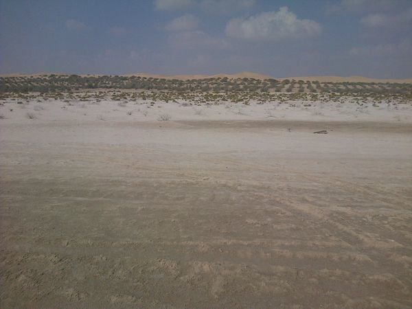
They’re boring to look at, at least for the casual passer-by: an apparently featureless, flat landscape stretching back from the shoreline, sometimes for 20 or more kilometres inland. And they are indeed flat: it has been suggested that they are actually 10 times flatter than a pancake. No trees grow here naturally (though some have been planted along the highway) and they lack plant life. After rainfall they are highly treacherous: many a vehicle and many a camel has become bogged down in them. They look, to be honest, of very little importance.
Abu Dhabi’s sabkhas are, in geological terms, “carbonate-evaporate depositional environments” formed by the interaction between the highly saline water table just beneath the surface and the grains of sand. They appear to have begun to form around 6,000 years ago as a result of a gradual decline in sea level from a high point about two metres higher than at present, and have gradually extended outwards, linking up with offshore islands such as those that form the outer core of the Dabb’iya peninsula. They have extended inland, too, as the surface sand is blown away down to the wet zone just above the water table. It is a complex and a fascinating process (to geologists anyway :) ).
Geologists who have been studying our sabkhas tell me that they are one of the few places in the world where the interplay between two different processes of sedimentation – carbonate and evaporate sedimentation – can be studied. Indeed, our sabkhas are actually the best place in the world to study this geological process. They are, quite simply, unique.
As a result, geologists from all over the world come to Abu Dhabi, many on trips organised by leading oil companies, since our sabkhas also provide important insights into how oil and gas reservoirs were formed millions of years ago. Two particular areas are of enormous scientific interest. One is west of Abu Dhabi, opposite the island of Al Qanatir, just beyond the Dabb’iya peninsula. Here geologists can study the gradual transformation of the surface for over a kilometre stretching inland from the shoreline, and if they dig down they can look at the processes by which crystals of gypsum and layers of a white, sticky mineral known as anhydrite are formed. (This can also be seen at the "Flowers in the Desert" earthcache).
Their unique importance to scientists all over the world and their educational value locally make the sabkhas a national treasure. Petroleum geologists have long argued for a long time that they should be afforded some kind of long-term protection – a proposal which I wholeheartedly endorse as a outdoor enthusiast, geocacher and off roader.
Reference:
Peter Hellyer is a writer and consultant specialising in the UAE’s heritage and environment. This was extrcted from an interview in the National Newspaper.
The main learning aim for this cache is for you to learn about these "boring" flat areas and see the significance. Also to understand the potential dangers of crossing these areas. Plus understanding why they formed.
In order to substantiate your visit and be able to claim this Earthcache, a number of questions need to be answered and submitted to the cache owner, via e-mail.
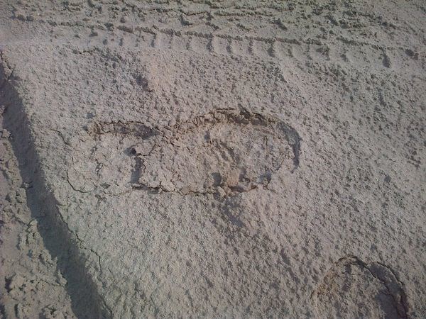
1. Describe in your own words what the crust of the sabkha looks like to the naked eye. The crust is also the “anhydrite” layer.
2. Describe in your own words what the crust of the sabkha feels like when you rub it between your fingers.
3. Look around and describe the gypsum crystals that are visible. BTW: there are much larger examples (probably due to the slower crystal growth rates) further from the sea – especially around Khalifa City in amongst the un-built areas where crystals larger than a hand are quite common.
4. Why would it be more dangerous to drive over the sabkha in the rainy season?
5. Give your impressions of the area and some observations that you and your team made about this location (not necessarily related to the sabkha)
6. Although not compulsory it would be great if you also post a photograph of you or your team standing on the sabkha with your log.
NOTE: You may log your visit prior to approval, but e-mail submissions that do not meet the above criteria will be deleted.
