This 50th Anniversary Event is brought to you by a member of: 
Working hard to promote Geocaching in Alaska! Please join us today!
Fifty years ago, at 5:36pm on Good Friday March 27 1964, the strongest earthquake ever recorded in North America shook southcentral Alaska. Ground motion lasted for over four minutes, and by today's measurement standards the quake is recorded as a 9.2 magnitude event. Damage was widespread from shaking, landslide, and tsunami impacts. Most property damage in Anchorage was caused by landslides, and because of low population density and the timing of the quake the loss of life was remarkably low given the strength of the earthquake.
Here at Turnagain Heights seventy-five homes were destroyed and four people lost their lives in one of Anchorage's most destructive earthquake-induced landslide events. After the first 90 seconds of shaking, clay layers below ground 'liquified' and gave way, releasing an 8,000 foot long section of the bluff here to slide into Turnagain Arm. The slide zone had extended 1,200 feet back south from the bluff's edge by the time all ground movement from the slide had ceased. The landscape left behind provides mute testimony to the need for soil analysis prior to building in earthquake-affected areas around Anchorage which may not look visibly susceptible to a slide event at first glance.
We'll gather at 5:30pm in the parking lot, then immediately walk over to the slide zone overlook. NorthWes will lead interested cachers through the western side of the slide zone down the Tony Knowles Coastal Trail to observe geologic details needed to complete a soon-to-be published EarthCache at this site.
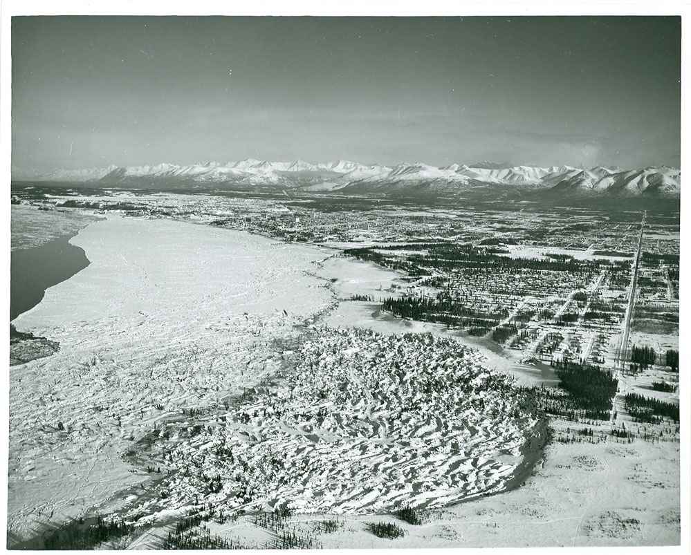 Looking NNE over the 1964 Turnagain Heights Slide