This cache is the 17th (and last) in the series and can be found at St. Peter's, the Parish Church of Onchan. By this stage the walkers who reach this point will have been on their feet for between 14 and 23 hours, but their hopes of glory will be extremely high as they head for the finish line by the War Memorial on Douglas Promenade.
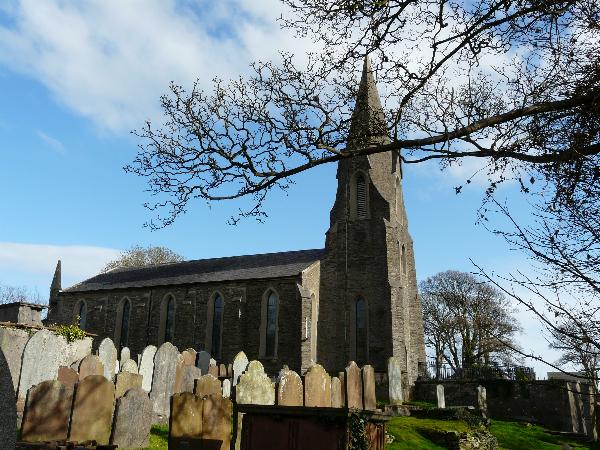
The village of Onchan (formerly known as Kirk Conchan, as it was dedicated to St. Conchan) is situated on a headland to the north of Douglas (of which it is a suburb), and has good views over Douglas Bay. The parish stretches from Windy Corner on the TT course in the north to Port Groudle and the town of Douglas in the south; it is bounded to the west by the River Glass and the East Baldwin Valley, to the east by the parish of Lonan and to the south by the Irish Sea.The main settlement in the parish is the village of Onchan which has the second largest population on the island. The coastline comprises the northern part of Douglas Bay and the Banks' Howe headland (which is 120 m high). The highest peak in the parish is Cairn Gerjoil, near Windy Corner, at 445m or about 1,460 feet (450 m).
This final cache in the series has been made as easy as possible so everyone can find it, but hopefully not the dreaded MUGGLES.
Parking is available in the Church car park. Please replace the cache exactly as found, and bring your own pencil/pen. As usual, WATCH OUT FOR MUGGLES!
Happy caching and we hope you have enjoyed the series.