This cache is placed with permission. Please follow all park rules, noting that the park is open Dawn to Dusk (no night caching, please).
Cell service will be limited in various areas on the AMNHA Geo-Path. Please plan accordingly.
Questions or need to share a challenge with a cache?
Send us a message in the Geocaching app
Remember to bring a pen, items to trade, and follow recommended
Geocaching Etiquette
.
CONGRATULATIONS TO RED CROW, BOO2931, AND NIXANT FOR BEING THE FTF!

AMNHA Geo-Path Series
AMNHA: Upper Alexander Lake
Passport: Geo-Path
Series: Panola Mountain Pathways
Password: Located in the logbook
Hours: Sunrise to Sunset
Parking Options: See waypoints (paid or free)
This search will bring you along the Rockdale River Trail in Panola Mountain State Park.
Enjoy the scenery as you hike or bike these trails.
The Rockdale River Trail can be strenuous at times, so be sure to carry plenty of water.
Please re-hide the cache carefully so others can enjoy the experience as well.
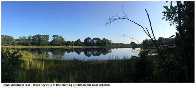
Upper Alexander Lake is one of two lakes within Panola Mountain State Park near Stockbridge, Georgia.
Together, Upper and Lower Alexander Lakes cover approximately 35 acres and are separated by a spillway.
The lake is a popular spot for fishing, with accessible bank areas and a bridge featuring fishing platforms.
In spring, bass and bream can often be seen spawning. Largemouth bass are catch-and-release only.
The area is also well suited for kayaking, canoeing, and hiking along the Alexander Lake Loop Trail.
The Alexander Estates played a significant role in the history of Upper Alexander Lake.
In the 1950s, Freeman and Marion Alexander purchased approximately 350 acres as a private retreat.
Freeman built Alexander Lake himself, dividing it into upper and lower sections with a causeway.
For a time, fishing access cost just one dollar.
As development pressures increased in the late 1990s, the Alexander family worked to protect the land.
Ed Alexander, Freeman’s son and a founding member of Arabia Alliance, helped guide conservation efforts
that led to the state’s acquisition of the property in 2002.
Near the lake’s entrance on Flat Bridge Road stands the Parker House, the oldest residence in Rockdale County,
built around 1822. Once central to a plantation where enslaved people labored, the house now serves as a
reminder of the area’s layered and complex history.
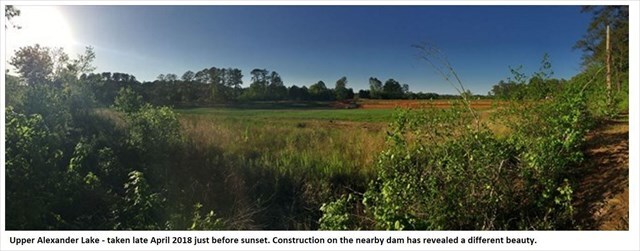
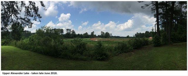
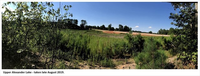
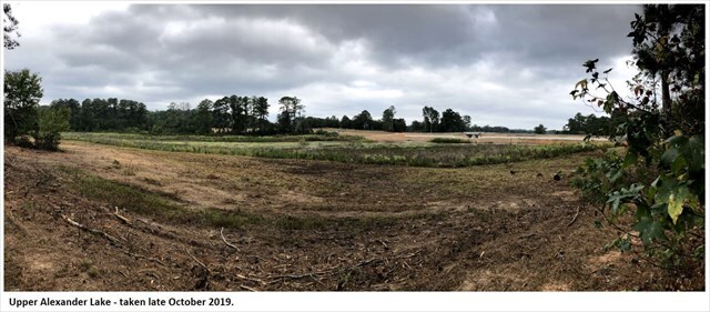
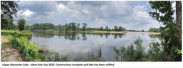
The landscape you see today did not happen all at once.
The photos below highlight different chapters in the story of this place over time.
Upper Alexander Lake has seen several construction and restoration projects designed to enhance recreation
while preserving its natural and historical significance.
• Between 2012 and 2013, greenway trails were built to connect the Rockdale River Trail to the park’s visitor
center and loop around Alexander Lake, improving walking, running, and biking access through the woodlands.
• Facilities such as the Alexander Lake Pavilion were developed to support community events and gatherings.
• In 2017, the Georgia Department of Natural Resources repaired the park’s earthen dams, including those at
Upper Alexander Lake. Built more than 60 years ago, the dams were deemed unsafe in 2015, leading to a
temporary closure of fishing and boating. These repairs helped restore recreational access.
• Future plans include a natural playground built with boulders near the southern end of the lake, creating
a hands-on space for children and families to connect with nature.
Are You Ready to Find More Geocaches?
Come explore the
Arabia Mountain PATH
and earn trackable prizes along the way.
The
AMNHA Geo-PATH
is a geocaching program spread across more than 30 miles of trail.
Many geocaches are waiting to be discovered.
Download the passports
Geocaching Adventures Passport
Each cache is classified into one of the following series:
• Adventure Labs
• Arabia Mountain Adventures
• Geocaching 101
• GeoTour
• Lands Less Visited
• Lithonia's Historic Hike
• Panola Mountain Pathways
• Past and Present Passages
• South River Stroll
Completed the passports?
Choose one of the following options to claim your prize:
Scan and email the Arabia Alliance Team
Scan and mail to the Arabia Alliance office
Additional Links
Trail Maps and
Landmarks
Learn and
Activities
Tips for Hiking in the Summer Heat
Tips for Avoiding Ticks
Winter Hikes and Winter Wildlife
Waypoints and
Adding or Viewing Coordinates
Trails Map Type Option