[SVE]
”Hammarudda” kan härledas till fornsvenskans ”hammar” som betyder stenig eller bergig höjd. Under bägge världskrigen har denna udde varit strategisk viktig i försvarssynpunkt och därmed utbyggts med omfattande försvarsanläggningar. Dessa sprängdes efter krigsslutet i samband med att Åland fick en demilitariserad ställning. Spåren efter dessa anläggningar kan man se lite varstans i området.
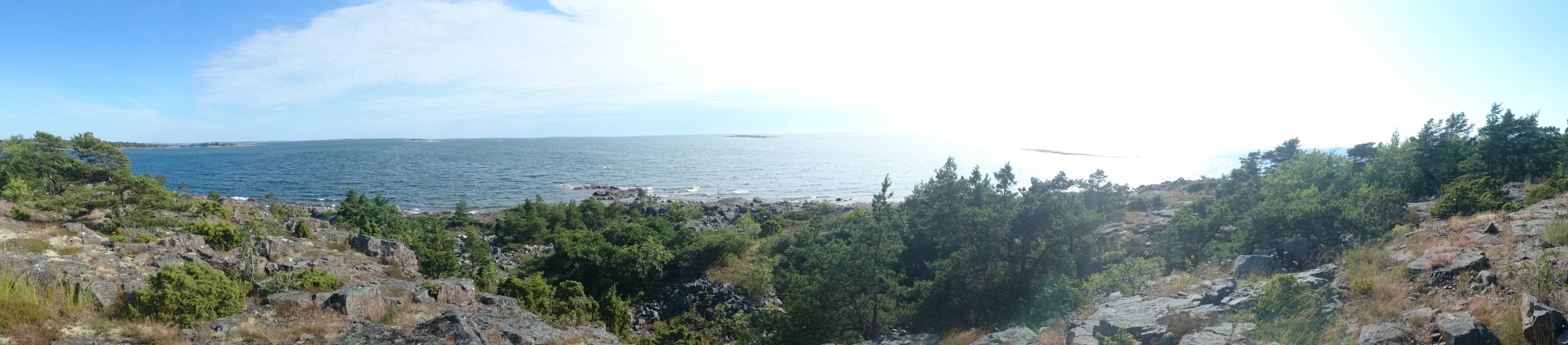
I området finns en vandringsled som är en del av Jomala vandringsled och markerad med vita markeringar. Denna cache ligger längs denna led och för att hitta cachen; parkera på den angivna parkeringsplatsen och följ de vita markeringarna ca 500 m. Då leden nyligen är omgjord, finns i början ingen stig men tydliga markeringar. Väl framme finner du en helt oskyddad plats och en fin utsikt över Ålands hav. Ta med lite fika och passa gärna på att gå hela leden runt, när du ändå är där.
I burken finns en loggbok och en penna från start.
OBS! Du behöver inte leta bland de sprängda stenarna!
[ENG]
"Hammarudda" can be traced to ancient Swedish "hammer" which means stony or rocky height. During both world wars, this cape was strategically important as a point of defense and several fortifications were built on it. They were all destroyed after the war when the Åland Islands beacame demilitarized. All over the area you can see traces of this destruction.
In the area is a hiking trail that is part of Jomala hiking trail and marked with white markings. This cache is located along this route and to find the cache; park in the designated parking area and follow the white markings about 500 m. The trail has recently been change a bit so at the beginning there is no path but the markings should be easy to find anyway. Near ground zero you will find a place, completely unprotected from the sea and a nice view of the Sea of Åland. Bring some coffee and take a chanse to descover the entire trail while you're there.
The container has a logbook and a pen.
NB! You don't have to look among the shattered rocks!