Niue has a great number of 4WD tracks in the interior, constructed to give access to bush gardens of the past and present. They are ideal for exploring on a mountain bike, so five different routes have been designated as bike tracks and signposted as such. Bikes are available from some accommodation providers and rental car firms.
Printed maps and descriptions of the bike tracks are available from the Niue Visitor Information Centre. The descriptions, as here, are all for biking around clockwise. Waypoints are given, or geocaches placed, where you leave the sealed road, at major junctions, and where you return to the sealed road.
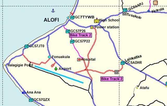
Turn off the sealed road at Lalokafika and brake to a halt as you enter the forest; preferably park out of sight of the house across the road if in a car. When you have found the cache here, carry on to the 5 cross roads waypoint.
All geocaches within the mapped area as at 1 June 2019 are shown.
A Topo50 Map of Niue, PI04, is available at www.linz.govt.nz as a TIF file. This shows all the bush roads and tracks in much more detail than the maps on the cache pages. A Garmin compatible map of the island showing all roads, tracks, etc is available from alsjfs on request.

Lalokafika
BYO pen/pencil. The cache container is a 400ml Sistema. The log sheets for all these caches are Rite in the Rain paper, so a pencil will be preferable if it is raining.