ERUPÇÃO DO PICO DO SAPATEIRO
[S. Miguel – Azores]
EARTHCACHE

PORTUGUÊS

PICO QUEIMADO/PICO DO SAPATEIRO
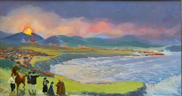
O historiador Gaspar Frutuoso, vivo à data deste episódio vulcânico, refere, a propósito deste algar, que dele brotou “...uma ribeira de fogo pela Ribeira Seca abaixo até chegar ao mar, correndo mansamente como metal derretido...".
Não foi somente a lava emanada da erupção vulcânica através deste algar que contribuiu para a origem do Pico do Sapateiro. Foi antes formado a partir de uma série de vulcões que se verificaram no sul da freguesia da Ribeira Seca, de que restam ainda algumas crateras. Na parte superior deste pico pode assim observar-se quatro pequenas crateras, uma das quais encima este algar, formado durante a erupção vulcânica de 1563.
O Pico do Sapateiro, assim chamado "... por em outro tempo ser de um oficial deste ofício" (Gaspar Frutuoso) é hoje conhecido por Pico do Queimado.
Esta cache tem por objetivo dar a conhecer a dinâmica e vestígios das consequências da erupção vulcânica verificada em 1563, que esteve na origem do Pico do Sapateiro, hoje denominado Queimado.
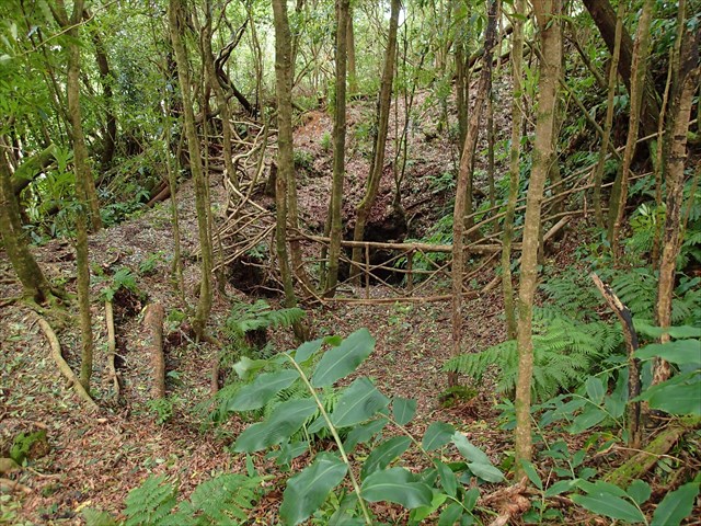
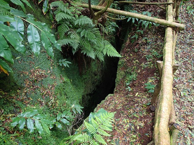
O “algar” do Pico Queimado é uma formação geológica localizada na vertente NW do Pico Queimado e corresponde a uma antiga chaminé vulcânica localizada na freguesia de Santa Bárbara, concelho da Ribeira Grande, nesta Ilha.
Esta cavidade apresenta uma geomorfologia de origem vulcânica em forma de algar, dotado de cone vulcânico, com cratera vulcânica localizada em domo traquítico.
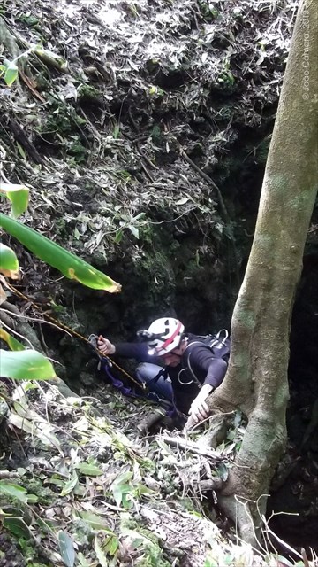
Este acidente geológico apresenta uma respeitosa profundidade de 37 metros e desaconselhamos que tente descer sem ser conduzido por pessoal experimentado e equipamento de escalada adequado. Mesmo para os mais experientes, a sensação de abismo é quase sempre assustadora…
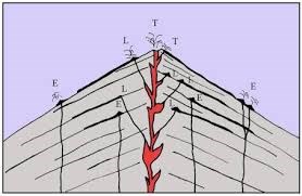
Este “fenómeno geológico”, para esta earthcache…, é constituído por uma fenda vulcânica(way point 1), por um cone vulcânico secundário(way point 2) e pela crateraprincipal (GZ).
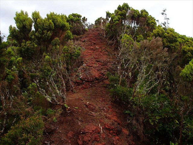
TRILHO TM02
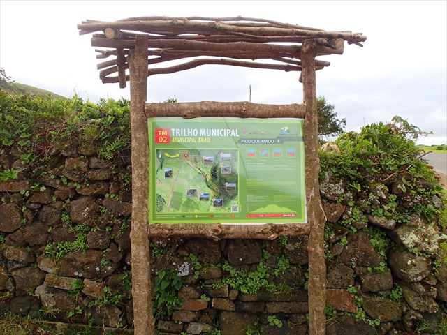
Este trilho municipal foi inaugurado no final de novembro de 2014 e reforça a oferta turística e de lazer a quem gosta de estar em contato com a natureza e manter-se ativo através da caminhada. Inicia-se ao quilómetro três da estrada secundária da Mediana, no sentido norte-sul, Santa Bárbara – Cabouco. É um trilho com cerca de 2,5 quilómetros de distância de valor vulcanológico e paisagístico.
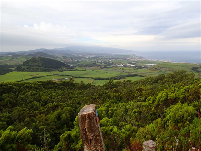
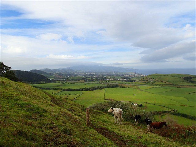
Durante este passeio é possível desfrutar de diversas vistas sobre a costa norte, nomeadamente sobre a cidade da Ribeira Grande, assim como para toda a zona oeste da ilha de São Miguel, desde o vulcão do Fogo até ao vulcão das Sete Cidades.
PARA REALIZAR E REGISTAR ESTA EARTHCACHE:
PERGUNTAS:
Para “encontrar/registar” esta cache deverá: provar que esteve no local e responder às seguintes questões, enviando um email/mensagem de Geocaching, com as respostas, em português ou em inglês, para o nosso perfil.
Só depois, de enviar as respostas, e conforme as “guidelines” para as Earthcaches, deverá efetuar o seu registo!
Serão removidos todos os registos que não obedeçam a estes requisitos.
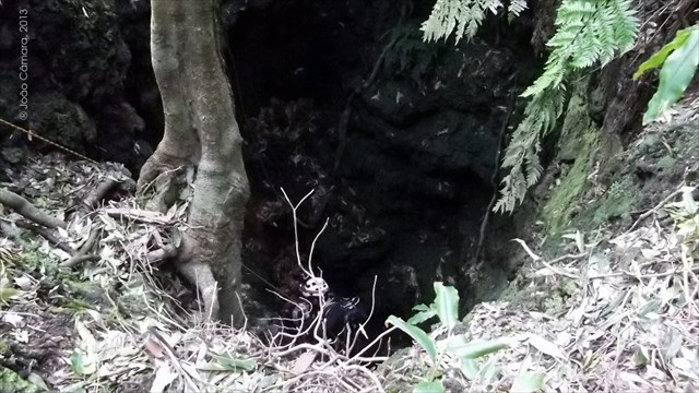
1. Observando o way point 1 (fenda vulcânica), responda às seguintes questões:
a) Em que ano se deu a erupção do Pico do Sapateiro?
b) Do tronco principal da árvore, que “sai” da fenda, quantos outros troncos saem?
2. Observando o way point 2 (cone vulcânico secundário), responda às seguintes questões:
a) Classifica o tipo de vulcão, que existiu neste local.
b) Estima o diâmetro do buraco, deste cone vulcânico secundário.
c) Existe alguma zona da vedação, a partir de onde se consiga ver o fundo do “buraco”?
d) Qual é a forma deste buraco?
e) Qual é a profundidade deste cone vulcânico secundário?
f) O que existe no fundo do buraco?
3. Observando o GZ desta earthcache (cratera principal deste aparelho vulcânico), responda às seguintes questões:
a) Caracteriza a cratera vulcânica principal, do ponto de vista vulcanológico/geológico.
b) Estima, usando o GPS, o diâmetros da cratera principal.
c) O que se vê no fundo da cratera?
d) Que “marca humana”, existe no fundo e centro desta cratera?
4.
TAREFA OBRIGATÓRIA:Deverá tirar uma foto sua, onde você apareça (ou com um papel/placa onde conste o seu nickname e a data da visita) e que comprove a sua presença no GZ desta EC - NÃO METASPOILERS. Esta foto deverá ser colocada no seu registo ou enviada por email ou sistema de mensagens de Geocaching, para o owner!
Não responderemos ao seu contato, a não ser que haja algum “problema” com as suas respostas ou registo.


ERUPTION OF THE SHOEMAKER PICO
[S. Miguel - Azores]
ENGLISH

EARTHCACHE
PICO QUEIMADO/PICO DO SAPATEIRO
The historian Gaspar Fructuoso, lived the date of this volcanic episode, he says, the purpose of this grotto, from which sprang a fiery stream by “Ribeira Seca” below to reach the sea, running quietly as molten metal ...".
It was not only the lava emanating from the volcanic eruption through this grotto that contributed to the origin of the Pico do Sapateiro. It was long before, formed from a series of volcanoes that have occurred in the southern parish of “Ribeira Seca”, from which there are still some craters. At the top of this peak can therefore be observed four small craters on top of which this algar formed during the eruption 1563.
The Pico do Sapateiro, named "... for another time be an officer of this office" (Gaspar Frutuoso) is now known as Burnt Peak (“Pico Queimado”).
This cache aims to make you understand the dynamics and traces of volcanic eruption the consequences seen in 1563, which led to the Shoemaker Pico (“Pico do Sapateiro”), now called Burnt Pico (“Pico Queimado”).
The "grotto" of "Pico Queimado" is a geological formation located in the NW part of "Pico Queimado" and corresponds to an ancient volcanic chimney located in the town of Santa Barbara, municipality of Ribeira Grande, on this Island.
This cavity has a geomorphology of volcanic origin in the form of a grotto, endowed with volcanic cone, with volcanic crater located in "traquítico" dome.
This geological accident presents a respectful depth of 37 meters and it is discouraged to try and climb down without being led by experienced personnel and proper climbing equipment. Even for the most experienced, the feeling is almost always frightening abyss ...
This "geological phenomenon" consists, for this earthcache…, of a volcanic fissure(way point 1), by a secondary volcanic cone(way point 2) and the main crater(GZ).
TRAIL TM02
This city trail opened in late November 2014 and reinforces the tourism and leisure offer for those who enjoy being in touch with nature and keeping active through walking. It starts at kilometer three in the Median country road, in the north-south direction, Santa Barbara - Cabouco. It is a trail of about 2.5 miles away from volcanological and landscape value.
During this tour you can enjoy various views of the north coast, in particular on the city of Ribeira Grande, as well as to the entire western part of the island of São Miguel, from the “Lagoa do Fogo” up to the volcano of “Sete Cidades”.
TO PERFORM AND LOG THIS EarthCache:
QUESTIONS:
To "find / register" this cache must: prove that visited the site and answer the following questions by sending an email / message Geocaching, with answers (in Portuguese or in English, only) to our profile.
Only later, sending the answers, and as the "guidelines" for EarthCaches should make your registration! They will be removed from all records that do not meet these requirements.
1. Observing the way point 1 (volcanic fissure), answer the following questions:
a) In what year was given the eruption of "Pico do Sapateiro"?
b)From the main trunk of the tree, which "leaves" of the fend, how many other branches/logs do come out?
2. Watching the way point 2 (secondary volcanic cone), answer the following questions:
a) Classifies the type of volcano, that existed in this site.
b) estimate the hole diameter, in this secondary volcanic cone.
c) There is some fenced off zone, from where you can see the bottom "hole"?
d) What is the shape of this hole?
e) What is the depth of this secondary volcanic cone?
f) What's is in the bottom of the hole?
3. Watching the GZ this EarthCache (main crater of this volcanic apparatus), answer the following questions:
a) Describe the main volcanic crater, from a volcanological / geological point of view.
b) Estimate, using the GPS, the diameter of the main crater.
c) What do you see in the bottom of crater?
d) The "Human Mark", is at the bottom or at the center of this crater?
4.
TASK (not optional): You must take a picture of yourself, where do you show up, (or with a paper / plaque with your geocaching nickname and the date of the visit) and that proves your presence in the GZ of this EC - no spoilers please. This photo must be placed in your log or sent by email or Geocaching messaging system, to the owner!

We do not respond to your touch, unless there is a "problem" with their answers or register.