Español
El río Tajo (en portugués, Tejo) es el río más largo de la península ibérica, a la que atraviesa en su parte central, siguiendo un rumbo este-oeste, con una leve inclinación hacia el suroeste.
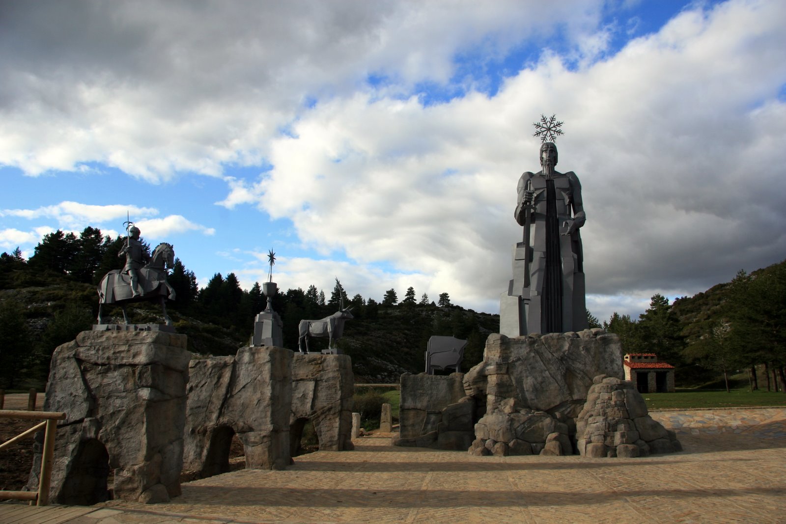
Nace a 1593 m de altura, en el paraje conocido como Fuente García, dentro del término municipal de Frías de Albarracín, en la provincia de Teruel en los montes Universales, en la sierra de Albarracín, después de recorrer 1007 km, llega al océano Atlántico en la ciudad de Lisboa. En su desembocadura forma el estuario del mar de la Paja (en portugués, Mar da Palha). En sus primeros 816 km atraviesa España, donde discurre por cuatro comunidades autónomas (Aragón, Castilla-La Mancha, Madrid y Extremadura) y un total de seis provincias (Teruel, Guadalajara, Cuenca, Madrid, Toledo y Cáceres).
Después de formar frontera entre España y Portugal a lo largo de 47 km, entra en este último. Aquí recorre 145 km, a través de las regiones tradicionales de Alto Alentejo, Ribatejo y Estremadura, en las que se integran los distritos de Portalegre, Santarém y Lisboa
Aguas subterráneas
El ciclo hidrológico comienza con la evaporación del agua de la superficie del océano. Cuando se eleva el aire húmedo, se enfría y el vapor de agua se condensa para formar nubes. La humedad se transporta alrededor del planeta hasta que vuelve a la superficie en forma de precipitaciónes. Una vez que el agua llega al suelo, uno de estos dos procesos pueden ocurrir;
1) una parte del agua puede evaporarse a la atmósfera
2) el agua puede penetrar en la superficie y se convierten en las aguas subterráneas.
Las aguas subterráneas son el agua encontrada bajo la superficie de tierra, contenida en los espacios dentro del suelo poroso y la roca. Las aguas subterráneas pueden ser obtenidas a partir de manantiales, perforaciones o pozos. Las rocas permeables tienen espacios diminutos entre las partículas de roca sólida, que permiten al agua y otros fluidos pasar y ser sostenida dentro de la estructura de la roca. Las rocas impermeables no tienen estos espacios y el agua no puede pasar por ellos.
Manantiales
Un manantial surge en el punto donde el límite entre una capa permeable de roca subterránea y una capa impermeable alcanza la superficie. El agua de lluvia se filtra por el suelo dentro de la parte permeable del subsuelo o de la roca subterránea. La filtración se detendrá si esta capa de subsuelo permeable se asienta sobre la cima de una capa impermeable y el agua no puede avanzar más. Dependiendo de la pendiente de las capas, el agua correrá a lo largo de la cima de la capa impermeable a un punto donde esta alcanza la superficie y surge como un manantial.
Condiciones favorables para la formación de manantiales:
Para registrar este earthcache, enviame un correo electrónico con las respuesstas para las siguientes preguntas:
1) ¿Cual es la orientación del manantial? ¿Y la de los 10 primeros metros del rio?
2) ¿A que distancia del arco mas cercano esté el manatial?
3) ¿De donde piensa que procede el agua que alimenta el manantial?
4) Añade una fotografia tuya en log, u otra en la que se pueda ver algún objeto, o tu nick en un papel
- Si piensa que a concluido con exito los objetivos de esta Earthcache y ya me envio todas las respuestas según lo pedido, por favor, proceda a logar el cache como encontrado, despues verificare las respuestas enviadas,y si es necesario, contactare con usted para efectuar las correcciones oportunas a su registro.
-Todos los logs sin respuestas seran apagados sin aviso.
English
The river Tagus (Tejo at Portuguese) is the longest river in the Iberian Peninsula, which crosses in its central part, along an east-west, with a nod toward the southwest.
Born at 1593 m above sea level in an area known as “Fuente García”, in the municipality of Frías de Albarracín at the province of Teruel in the “Montes Universales” in the Sierra de Albarracín, after traveling 1007 km leads to the Atlantic Ocean in the city of Lisbon. At its mouth forms the estuary of the Sea of Straw (in Portuguese, Mar da Palha). In its first 816 km through Spain, which runs through four autonomous regions (Aragon, Castile-La Mancha, Madrid and Extremadura) and a total of six provinces (Teruel, Guadalajara, Cuenca, Madrid, Toledo and Caceres).
After forming border between Spain and Portugal over 47 km, comes into Portugal. Here runs 145 km through traditional regions of Alto Alentejo, Ribatejo and Estremadura, where the districts of Portalegre, Santarém and Lisbon are integrated
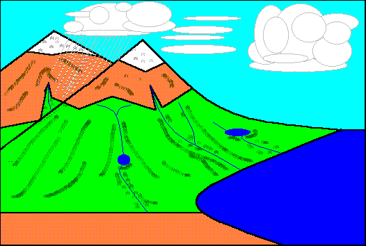
Groundwater is water found beneath the ground surface held in the spaces within porous soil and rock. Groundwater can be obtained from springs, boreholes or wells. Permeable rocks have tiny spaces between the solid rock particles that allow water and other fluids to pass through and be held within the rock structure. Impermeable rocks do not have these spaces and water cannot pass through them.
Springs
A spring occurs at the point where the boundary between a permeable layer of underground rock and an impermeable layer reaches the ground surface. Rainwater percolates through the soil into permeable layers of subsoil or underground rock. The downward percolation will be stopped if this layer sits on top of an impermeable layer and the water can go no further. Depending on the slope of the layers, the water will run along the top of the impermeable layer to a point where it reaches the surface and emerges as a spring
Favourable conditions for spring formation:
To log this earthcache, send me an email/message with the answer to the following questions:
1) What is the orientation of the spring? And the first 10 meters of the river? (S-N, E-O, etc)
2) How far is the spring water from the nearest arch?
3) From where do you think that comes the water that feeds the spring?
4) Add a photo of yourself in log, or another in which you can see an object, or your nick on a piece of paper
-If you believe you have successfully completed this Earth Cache goals and has already sent to me all the requirements as requested, Please, feel free to log it as found. Later i will verify the requirements sent and, if necessary, contact you in order to make the necessary corrections to your log.
-Logs without answers, will be deleted without notice.