Navigating with a GPS is easy for some, but still a challenge for others. How would you go navigating without a GPS? Especially, if there are no road maps to guide you? In this puzzle we will see, how well you will do without a GPS...
For this cache you will need a map of Albany – one of the ones readily and freely available from the Albany Visitor Centre and some other outlets (Albany Advertiser on York St and others). (See image)
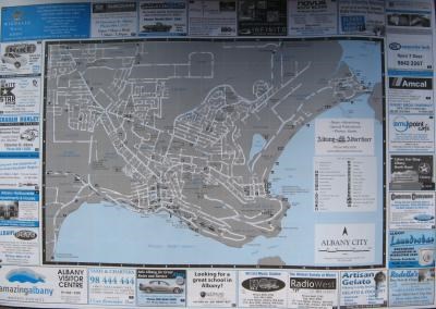
With this in hand, the other things you will need are a pencil to plot the course, dividers to measure the distance according to the scale printed on the map, a couple of triangle rulers or parallel rules, a compass rose (protractor) and a smile on your face  (Ok, you can probably do without the parallel rules, but you would normally use them to transfer the direction from your compass rose on the chart to your course.)
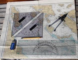
For the purpose of this exercise we will omit the fact that there are things like magnetic bearings, compass deviation and other troublesome issues in plotting a course out at sea and we will use straightforward instructions.
Assuming the grid on the map is running in a north / south direction, draw yourself a compass rose in the bottom left corner of Princess Royal Harbour (if you are using the grid as a guide, the four main directions will be straight along the lines, with NW, NE, SE and SW being diagonals through your “square” and NNE can be found by going two squares on the grid E and 5 squares N – the other directions would be done accordingly). A compass rose always starts with 0 degrees being North and 90 degrees being East, with all the others filling the 180 degrees of the compass rose.
Using the very end of the Town Jetty on the “Albany City” map as a starting point, plot a course as follows:
Travel
1.5 km SE (@135deg)
3 km @ 80deg (slightly north of E)
3.5 km N (@ 0deg)
Here you should be headed to a beach, which has access to a nearby Rd. Heading north across the beach find the track (now on land – google maps helps here) to the path running along the beach. From where beach-access, track and road meet, walk 58 m in a ENE -erly direction. Here the treasure should be an easy find on the north western side of the track.
For some plotting help have a look here:
http://www.schoolofsailing.net/plotting-positions-and-courses.html
http://www.oceannavigator.com/March-April-2014/triangles-and-dividers/
or look up Google for “Plot Your Course - National Ocean Service – NOAA”
Keep smiling and enjoy yourself