I was looking at the map one day, and I saw this notation that said "YUMA NUMBER ONE AIRFIELD." I Googled it and found that there was an old satellite airfield out here that was active in the 1940s.
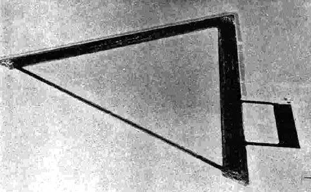
Here's an old photo of it from 1943:
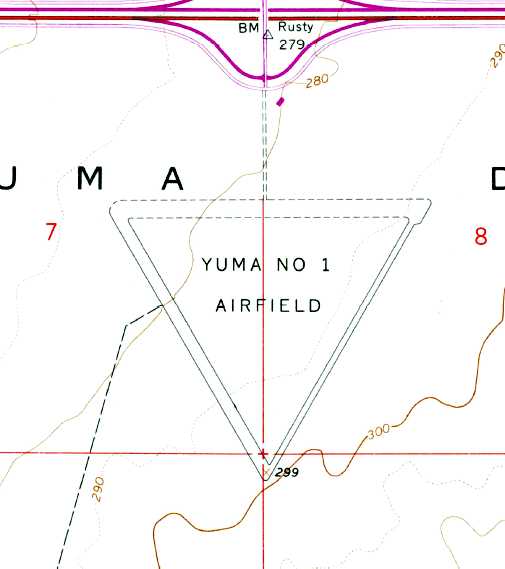
And here it is on a map just south of Interstate 8:
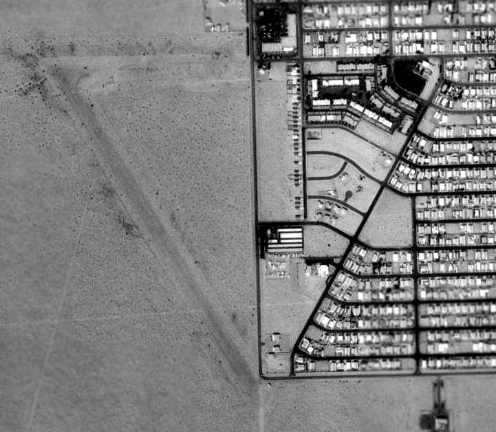
This is a USGS aerial photo from 1992 that shows the abandoned air field being reused as a residential street:
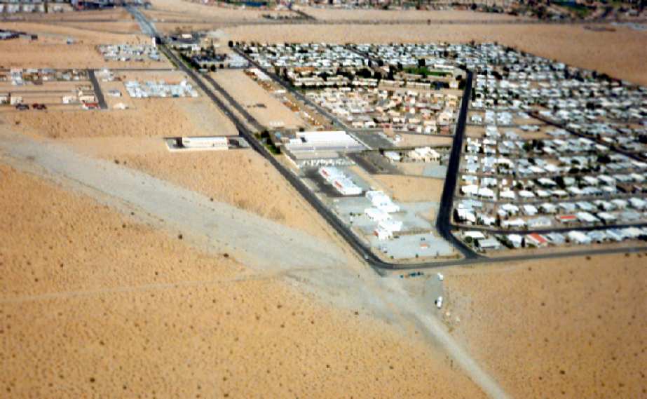
Here's another shot from as recent as 1997 which clearly shows the abandoned airfield:
And finally, here's the shape of the airfield and the current aerial map. South Mesa Drive reuses the right flank of the old airfield:
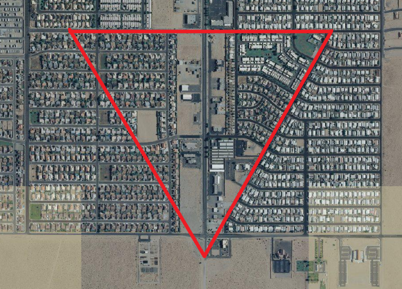
And now you know why this street is at such an unusual angle. Have fun hunting for the cache!
Source: Abandoned and Little-Known Airfields: Arizona.