Walk along the riverside footpath from Cache No 8 to this cache ***renamed cache to include it in the wider Guiding around Hautbois series*** (Which will be published very soon!)
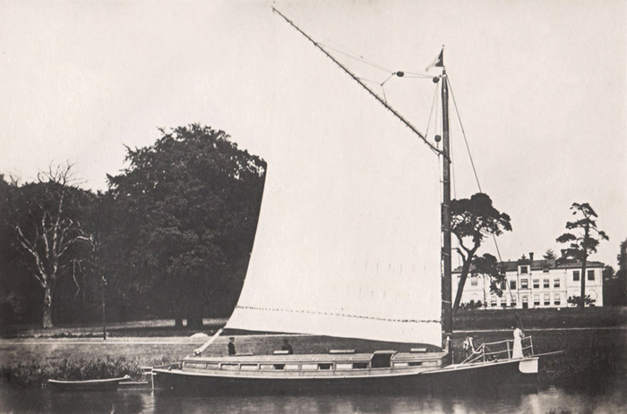
The village of Coltishall boasts a long and fascinating history. In 1231 King Henry III made Coltishall a free town. This gave the inhabitants certain privileges and freed them from serfdom. Historians are still unsure today about why Coltishall was granted such an honour! The brewing industry played a central role in Coltishall’s history for 250 years, being a famous malting centre supplying famous brewers like Guinness. Wherries transported barley to more than a dozen malthouses. In fact, Coltishall has been called the birthplace of the wherry and certainly many wherries were built there. In the 1880s, Coltishall became a hub of industry with blacksmiths, shoemakers, thatchers, basket makers, harness makers and wheelwrights all residing in the village.

Residents of Hautbois House had quite an influence over the village over many years, due to Girling, a resident from 1859 who supported a project to provide work for men of boys of the parish – digging out marl from the pits, baking it in kilns on site and then shipping via the Cut to the Broads waterways. Subsequently a voluntary school was set up, and community life was enriched through concerts and excursions.
In August 1912 the road bridge was destroyed by the floods that devistaed the area. It had rained over several days prior to the storm but it had been raining heavily in the early hours of Monday 26th August 1912 and in less than 24 hours over 8” had fallen over the region. The accompanying gales ensured that the tide remained high and, as the water poured off of the land, the rivers were breached in many places causing mass flooding across Norfolk and Suffolk. Over 40 bridges were destroyed, railways became blocked and the harvest was lost. A number of lives were lost and thousands more were left homeless as the flood water swept through the region.