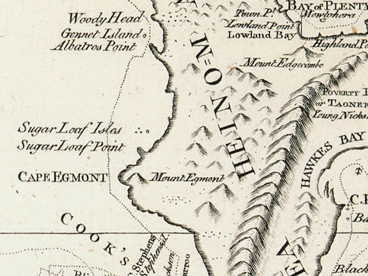
On Thursday 11 January 1770 Lieutenant James Cook aboard HMB Endeavour noted in the ship's log...
... At this Time Albetross Point bore North-East, distant near 2 Leagues, and the Southermost land in sight bore South-South-West 1/2 West being a very high Mountain and made very much like the Peak of Teneriff;...
Late the next day Cook again sighted the mountain and wrote...
...At 7 p.m. saw the top of the Peaked Mountain to the Southward above the Clouds bearing from us South; at the same time the Southermost land we had in Sight bore South by West...
On Saturday the 13th, Cook wrote in the ship's log...
...at 5 a.m. saw for a few Minutes the Top of the Peaked Mountain above the Clouds bearing North-East. It is of a prodidgious height and its Top is cover'd with Everlasting Snow; it lies in the Latitude of 39 degrees 16 minutes South, and in the Longitude of 185 degrees 15 minutes West. I have named it Mount Egmont in honour of the Earl of Egmont. This mountain seems to have a pretty large base and to rise with a Gradual Ascent to the Peak, and what makes it more Conspicuous is its being situated near the Sea and in the Midst of a flat Country which afforded a very good Aspect, being Cloathed with Woods and Verdure...
This geocache also sights on a good day a view across the sea of the Taranaki bight to mounga Taranaki, Cook's Mt. Egmont.

It's really nice towards Sunset

There's a handy track here leading down to the beach
Parking is at a premium here but there are rarely other vehicles to make it a problem