The cache is not at these coordinates.
But, this is where you should start your journey.
This is the next of Hike/Bike with Me caches that I have started since moving to MN. Since most of my cache finds are done while exercising, I thought I would offer this delight to others.
These caches will not necessarily be hard to find, but you will have to put some miles on the legs for them. So lace em up, grab some water, and come join the fun.
Your hike will be a circular route along the West side of Rapid Lakes Unit. Totally, this will be maybe 2.5 miles, depending on how much you wander around. The waypoints are all on trails, which can be accessed all year long. The final coordinates for the cache are placed in a winter friendly place not too far from the parking lot.
** This is a hunting allowed area, so please read the Hunting Advisory signs at the parking lot. **
All Refuge lands, including the Rapids Lake Unit are open from sunrise to sunset, 7 days a week. Trail conditions on the Refuge vary throughout the year. Be prepared, as you may encounter changes in trail conditions while hiking, including periodic flooding, wet or muddy areas, thorny vegetation, and rough ground. Trails are ungroomed in winter and may be snow-packed and icy. To protect wildlife, please stay on designated trails and keep pets leashed at all times while visiting the Refuge.
As for the waypoints ...
Q1 (Elevation Check) – Crack out your GPS or GPS App, and take a look at the elevation of this area. Is it closer to (1) 850 feet, (2) 1,100 feet, or (3) 1,225. Consider this A.
Q2 (Sign #1) – How many words are in big letters? Consider this B.
Q3 (Two Signs) – On the white sign, how many letters are in the first word? Consider this C.
Q4 (Sign #2) – There are two signs here. On the top yellow sign, there are some very small letters on the bottom. What is the last number there (after 4101). Consider this D.
Q5 (Final Sign) – On the white portion of this sign, how many letters are in the second word (beginning with a W). Consider this E.
OK, so grab a pen ...
Final:
44.44.0BA ----- 093.38.CED
Hope you had a great walk.
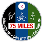
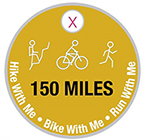
Earn the 75 and 150 mile Pathtag!
So far there have been 37 of these Hike/Bike/Run With Me Multi-caches - if you were to complete them all, you would have travelled more than 210 miles. Currently (August 2023), there are 32 active geocaches totaling 185 miles (This includes three Hike With Me Adventure Labs). I wanted to give something to the geocachers who have "put a big dent" in trying to find these. So I created two pathtags for all cachers who completed at least 75 and 150 miles while trying to get smileys on these caches. On each of the cache pages, I mention how long the travel should be for that cache. They vary from just a couple miles to a 20-mile mountain bike ride.
Here is a bookmark list of all of the caches.
So, take a look at your finds, add up the miles, and if you are more than 75 or 150 miles, let me know. You can either PM me, email me, or just grab me at an event. You do not have to show/prove anything to me about you qualifying. I will give you one if you say you have qualified.