This is a three staged earthcache based on the river terraces and floodplains beside the river Dodder in Dodder Valley Park in Old Bawn, Tallaght. The River Dodder (An Dothra - in Irish means ‘turbulent’) is a fast flowing river prone to overflowing and flooding. It rises on Kippure Mountain in County Wicklow and is approximately 29 kilometers long. It flows through Glenasmole valley, Templeogue and Rathfarnham entering and the Irish Sea at Dublin Bay. River Terraces can be seen along the banks of the river Dodder. They are interesting for geological reasons because they represent active land-forming processes instead of changes that occurred millions of years ago.
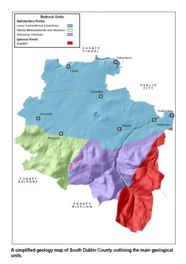
This area is part of the Leinster Granite chain. The northern half of the county is formed of Carboniferous Limestone rocks deposited in a deep marine basin. These rocks were formed around 340 million years ago and are faulted against the older rocks along the base of the mountains.
Over the last 2 million years the Ice Age had a big effect on the landscape, eroding the mountains, depositing glacial gravels in places. Rivers such as the Dodder have also been active in recent times, modifying the sediments at surface.
The Pleistocene Period or Ice Age began 2 million years ago and several cold periods interspersed with warm periods saw glaciers form across Ireland, with ice flowing across the lowlands of Dublin City. As a result the ice ground down and deposited till in thick blankets over the entire city area. During the last ice age called the Midlandian Cold Stage most of Ireland, including Old Bawn was covered by ice. The Midlandian Cold Stage ended 10,000 years ago, which is a very short time geologically. Since then the river Dodder has also modified the sediments at surface
The Dodder Valley is a flood plain which is flat area of land either side of the river, forming the valley floor . A floodplain is the most common depositional land form associated with rivers.
River terraces are seen in the Dodder valley. River terraces are old floodplains left perched above the current floodplain.They look like a series of flat-topped, elevated terraces that stand much higher than the current Dodder River. A number of processes are involved in their formation.

There are three main types of processes that occur in a river.
These are erosion, transportation and deposition. All three processes depend on the amount of energy there is in a river.
Erosion
The main ways in which erosion happens are:
• Corrasion - Wearing away of the river bed and banks by the load hitting against them.
• Attrition - Wearing down of the load as the rocks and pebbles hit the river bed and each other.
• Hydraulic Action - Breaking away of river bed and banks by the sheer force of the water getting into small cracks.
• Chemical Action (Corrosion) - Water dissolves minerals from the rocks and washes them away.
There are different types of erosion
1.Headward erosion makes a river longer.
2.Vertical erosion makes a river channel deeper.
3. Lateral erosion makes a river wider. This occurs mostly in the middle and lower stages of a river.
While Erosion plays a part in the formation of terraces, it is not the only factor involved. Terraces are preceded by floodplain formation and sediment deposition.
Transport The main ways in which transport happens are:
• Traction - Quite large stones can be rolled or dragged along the river bed by the force of the water.
• Saltation - Small stones which the water cannot lift bounce off each other and are carried forward by the water above the river bed for short distances.
• Suspension - If particles are small enough the river can lift them and carry them long distances.
• Solution - When the river dissolves minerals from the rocks they are carried in the water itself.
Deposition
The main way in which deposition happens is:
• Loss of Speed - When the river slows down on the inside of bends or when it meets deeper water, like a lake, it loses energy and cannot carry so much, so drops some of its load.
Rivers deposit sediment into stratified layers or beds, with sediments of a similar size being sorted together. The layers of sediment are clearly visible.
Depositional features can also be caused by glaciation. Glacial meltwater can deposit sediment. When as the ice melts sediment of all sizes, everything from smaller rocks to bigger boulders fall to the ground leaving an unsorted or irregular deposit called till . A till is called unstratified because it does not have layers. Till contains rock particles of all sizes. This is in contrast to action of rivers.
River Terraces form when the level of the land is raised relative to sea level (either because the land uplifts or the sea level drops) . In this case glaciation caused the terrace to form. After a period of glaciation, land starts to rise in response to the loss of the weight of the ice. This is called isostatic recovery and starts the process called rejuvination . River rejuvenation involves a renewed period of vertical erosion to achieve a new and lower base level.
Additionally the meltwater from the ice sheets flowed into the oceans, raising the sea level once again, and the land which had been beneath the ice began to rebound upwards, a process known as ‘postglacial rebound’.
Then river down-cuts to return to its equilibrium profile into its alluvial flood plain. The river has renewed energy for this erosion (any system in nature when disturbed from its point of equilibrium or balance will push hard to try to return to equilibrium). This leaves flat side terraces above the new level of the river. The new valley widens in time, forming a second flood plain within the first one, but at a lower level.
Terraces helped geologists to record the deglacial retreat of the ice sheet through south Dublin at the end of the last glaciation.

Geologists have found well-defined suites of glaciofluvial and delta terraces along the valley between Ballinacroeny Lower and Templeogue. They are linear forms and are generally subparallel to the meanders of the river, though some of the highest examples at Kiltipper are isolated fragments. All of these deposits are genetically related to the deglaciation of a prominent valley and its subsequent dissection by extraglacial meltwaters.
If you stand at the starting coordinates and turn around and look at the rear of the shopping center behind you, you will see the higher level of the first floodplain. Additionally at floodplain viewpoint across the river you will see a housing estate behind the parklands. These level surfaces are natural. The higher level represents the first flood plain.
In order to log a find you must answer the following questions:
Please email you answers to me via my profile.
At the starting coordinates:
1. Stand and look down. Describe what terraces you see. How many levels do you see?
2. How many meters below is the next platform or terrace?
Now its time to walk to the waypoint 2 in Dodder Valley Park on the other side of the river, which will bring you to the path close to the goal posts. The housing estate behind you is standing on a naturally level surface which was once the original flood plain.
3. How many meters below would you estimate the river is flowing from where you are standing on the floodplain/ upper path?
4.What type of erosion is at work here?
Waypoint 3 will bring you closer to the river. A slight scramble is involved. Please ensure you are wearing appropriate footwear and be careful if you are with young children or dogs as it will bring you close to water.
5. Stand at the viewing point. Look across the river to the bank on your right. The bank forms a cliff of approximately 5m. Look closely at the sediment in the cliff. Would you say the sediment in the cliff is stratified or unstratified? .
6. Optional: take a photograph of the river or the bridge. Please do not post photographs of the answers to the earthcache but all others are very welcome.
Happy Hunting
Sources: https://www.gsi.ie/NR/rdonlyres/D879538E-FDBB-40CC-A008-FA68AC3307B1/0/SD004_Dodder_Terraces.pdf Sources:https://www.gsi.ie/NR/rdonlyres/43859F05-3FF2-405C-8709-0D993C6C17B1/0/DC_main_report.pdf