| Taranaki has 20,000 kilometres of waterways and no less than 530 named rivers and streams of which over 300 flow from the flanks of Mount Taranaki in a distinctive radial pattern across the ring plain. |
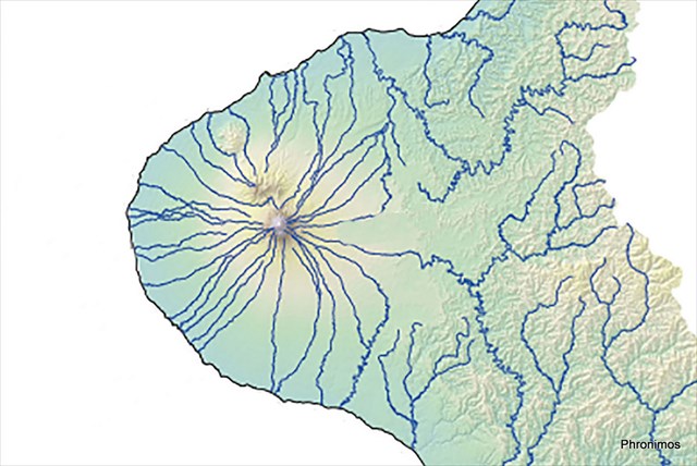 |
Regular and plentiful rainfall falling on the mountain, absorbed by the bush and slowly released by percolation, supplies a continuous fresh water supply for agriculture, industry and household consumption - perfect for growing grass on which our dairy industry is based. For this reason our rivers and streams really are the Backbone of Taranaki.
This cache is one of a series covering the major catchments of the Taranaki ring plain
highlighting the Backbone of Taranaki
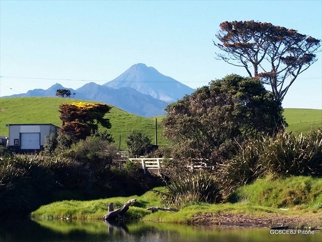
Pitone Stream catchment
|
Source of
Headwaters |
Annual
Rainfall |
Catchment
Area |
Incoming
Streams |
| Drains from farmland between Upper Pitone and Upper Timaru roads. |
2000 mm |
7.9 km2 |
|
Unfortunately the Pitone stream suffers degradation from farm dairy run-off from its progress through the catchment. But it is still pretty at its outfall, and is a popular swimming hole on the nearby beach.