[JP]
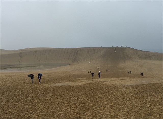
鳥取砂丘は、鳥取県鳥取市の日本海海岸に広がる広大な砂礫地で、代表的な海岸砂丘です。観光可能な砂丘としては日本最大で、山陰海岸国立公園の特別保護地区に指定されており、南北2.4 km, 東西16 kmに広がります。
[EN]
Tottori sand dunes are typical coast dunes located in a vast sand area extending along Japan Sea shore in Tottori city, Tottori prefecture. Tottori dues are the largest dunes for sightseeing in Japan, 2.4 km in south-north and 1.6 km in east-west.
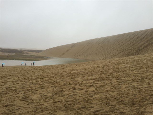
[JP]
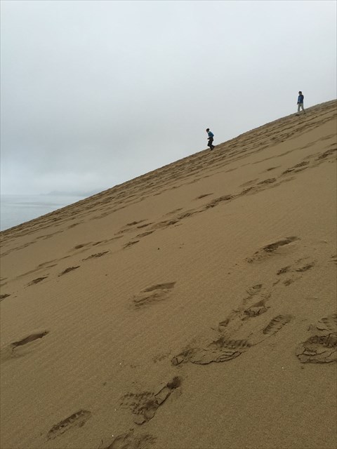
キャッシュオーナーが現地で撮影した写真をいくつか紹介します。
[EN]
Let's see some pictures taken by the cache owner there.
鳥取砂丘のでき方/How have Tottori dunes been formed?
[JP]
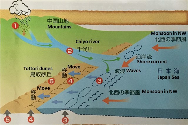
鳥取砂丘がどのように出来たのかを下の図を使って説明します。
[EN]
Formation of Tottori dunes is explained with the figure below.
[JP]
(1)中国山地の岩石が風化して砂になり大雨によって川に出ます。
(2)千代川によって大量の砂が日本海に流れ出ます。
(3)一度沖合に流された砂は、海の流れによって陸地に近づき、浅い海底に堆積します。
(4)波浪により海岸に砂が打ち上げられます。
(5)北西の季節風により吹き飛ばされて陸地に運ばれ、内陸側に積もって海岸砂丘になります。
[EN]
(1)Rocks in Cyugoku mountainous land are weathered, become sand.
(2)Chiyo river flushes a lot of the sand to Japan Sea.
(3)Once the sand is carried off shore, but comes back to the land by shore current and deposits on the shallow sea bottom.
(4)The sand is put up on the shore by waves.
(5)The sand is blown up to the land by monsoon in NW direction, and accumulates on the inner land and become shore dunes.
風紋/Sand Ripple
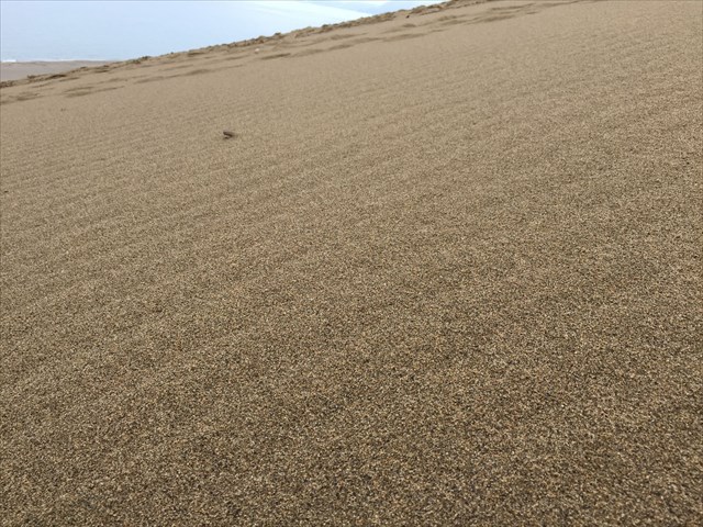
[JP]
(1)砂丘の砂が乾いている、(2)風速5-10m/sの風が吹いている、といった条件が揃うと、砂丘表面に波状のパターンである風紋が形成されます。下の写真はキャッシュオーナーが現地で撮影した風紋です。当日は雨が降っており砂が濡れておりましたが、前日に形成された風紋がそのまま残っていました。
[EN]
Wavy patterns on the sand, "wind ripples", are formed if some conditions, like (1)sand is dry, (2) wind speed 5 - 10m/s are met. The picture below is wind ripples taken by the cache owner. It was raining and the sand was wet, but the wind ripples remained as were.
[JP]
ジオパークセンターでは、風紋形成の風洞実験を行っており、解説を聞くことができますので、是非訪れてみてください。
[EN]
In Geopark Center at GZ, you can see a "wind tunnel experiment" of forming wind ripples. Please visit there!
オアシス/Oasis
[JP]
Additional Waypoint ”Oasis”では、下の写真のようなオアシスを見ることができます(夏場は干上がる場合があります)。このオアシスの水は、砂丘に降った水が砂地にしみこみ、地下にある水を通しにくい火山灰層の上に溜まったものであると考えられています。
[EN]
Around the Additional Waypoint "Oasis", you can see an oasis as shown in the picture below (but, it may be dried up in summer). The water of the oasis is rain water pouring on the sand and stands on the water-impervious volcanic ash layer underneath the sand.
古砂丘と新砂丘/Ancient sand dune layer and Recent sand dune layer
[JP]
鳥取砂丘は、古砂丘層と新砂丘層とからなります。古砂丘層は、海底に厚く堆積した砂が、その後の海水面低下に伴い海面上に現れて砂丘を作ったもので、約12万年前までに形成された層です。新砂丘層は、古砂丘層の上に存在し、ここ2万年の間に形成された層です。
[EN]
Tottori sand dunes comprise Ancient sand dune layer and Recent sand dune layer. The Ancient sand dune layer thickly accumulated on the bottom of the sea and appeared above the sea as the sea level lowered by 120 thousands years ago. The Recent sand dune layer exists above the Ancient sand dune layer, and has formed during these 20 thousands years.
Task
[Task 1]
[JP]
Found logを書く前に以下のクイズの回答をキャッシュオーナーに送ってください。
[EN]
Before claiming your found log, send your answers for the quizzes below to the cache owner.
Quiz 1
[JP]
追加ウェイポイント”Observation point 1”と”Observation point 2”のそれぞれにおいて砂を観察して、(1)砂粒の大きさ、(2)砂粒の形状(角ばっているか、丸まっているか)、(3)砂粒の色(ex. 石英の透明度)を比べてみましょう。どのような違いが観察されるでしょうか?そのような違いが発生する理由は何でしょうか?
[EN]
Observe sand grains at the additional waypoints, ”Observation point 1” and ”Observation point 2” respectively. What differences in (1)grain sizes, (2) grain shapes (angular or round) and (3) grain color (ex. transparency of quartz grains) can you find? Why do such differences occur?
Quiz 2
[JP]
古砂丘層の形成と新砂丘層の形成との間にどうようなイベントが発生していたでしょうか? 追加ウェイポイント"Observation point 3"で回答のためのヒントを得ることができます。
[EN]
What events occurred between formations of the Ancient sand dune layer and the Recent sand dune layer? You can see a hint for answering at the additional waypoint "Observation point 3".
[Task 2](Optional)
[JP]
砂丘を背景に写真を撮ってFound logと共にアップロードしてください。
[EN]
Take a picture in front of the sand dune and upload it to your found log.