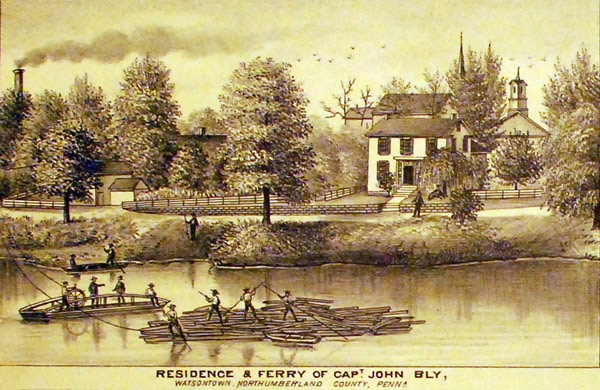
The canal boats fell into two categories, one for cargo and the other, known as packets, for passengers. Packets generally moved at the maximum speed and normally used the speedier horse as the optimum towing animal. Meals were provided on board along with sleeping accommodations for night travel. These boats were usually lighter and could make better time than a cargo boat. The cargo boats could travel 25 to 45 miles a day with the primary export being lumber, grain and whiskey while the primary import were manufactured goods. Because of the weight of cargo, mules were the normal means of towing and would work for six hours at a time. For company owned boats, mule barns were located along the way providing fresh mules thus allowing travel to continue uninterrupted. Privately owned canal boats tended to have two cabins, one for the family and crew and another for the mules. Canal boats could be 14 feet wide and 80 feet long and about 12 feet high with the capacity of carrying 75 tons (150,000 pounds) of cargo. -http://www.mywatsontown.com/?page_id=1467
There is parking at both ends of the path. There's a lot east of the bridge, right across from the BiLo. The canal path is not clearly marked from this side, and can be a bit confusing. Walk across the street, on the sidewalk, and you turn left into what appears very much to be a private driveway, but is in fact the entrance to the canal path. It is not marked here, unfortunately. The path will bear right.
. At the west end of the path, you may park at the West Milton Bank, the Towers, or across the street at the VFW. All three places have approved parking for those walking the path. There is a sign describing the path in front of the West Milton Bank, and the start of the path from that side is to the west of the evergreens, look for the arrow signs.