The Drakensberg is characterised by an abundance of high altitude mountain wetlands. These include high altitude tarns, springs, bogs, marshes and streams. These may be broadly classified as permanent rivers and streams, including waterfalls, permanent and seasonal marshes and ponds, with emergent vegetation waterlogged for at least most of the growing season, peatlands, freshwater springs, seasonally flooded meadows and sedge marshes.
These wetlands can be categorised into separate classes based on their position and the water flow type they are comprised of. The water regimes of the wetlands are described indirectly using soil morphology criteria.
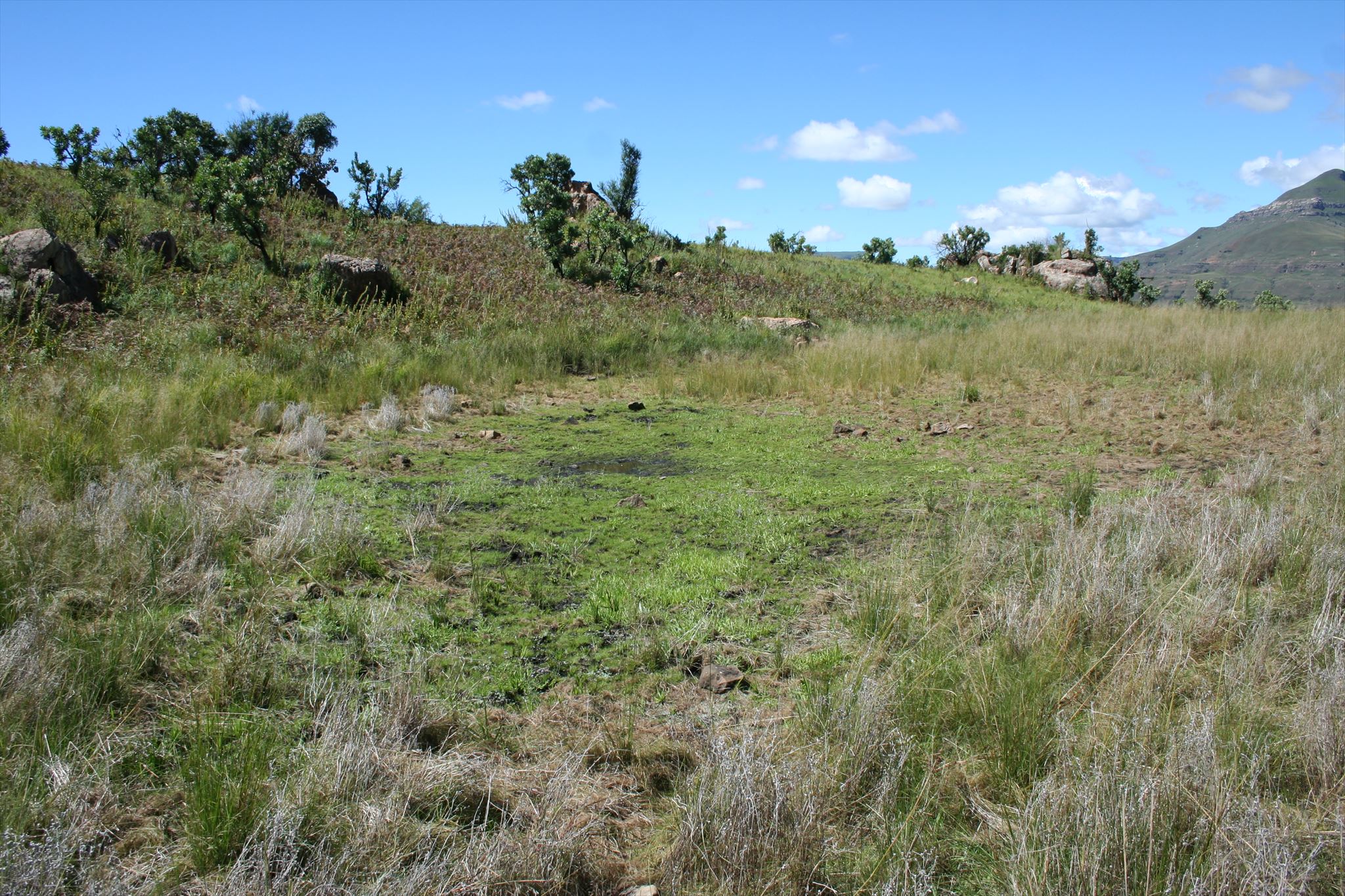
1. Depression settings
Depression settings occur on terraces or in valleybottoms, but tend to be more common and conspicuous on ridgetops, even on fairly narrow ridges. Wetlands in such settings are described as endorheic because they are inward draining and do not have an outlet.
2. Midslope and Valleyhead slope settings
Valley head wetlands can be flat and relatively large. However, most wetlands in valleyhead positions are sloped. Sloped valleyhead wetlands are functionally similar to sloped midslope wetlands in that both are:
- generally characterised by the discharge and/or throughflow of groundwater;
- usually situated high in the catchment;
- do not have stream channels within or entering them; and
- are usually small (<1 ha).
They also support similar vegetation types, mostly sedge/grass meadow. However, they differ in that valley head wetlands are drained by a stream channel (i.e. they occur at the 'eye' of the stream) but slope settings are not.
3. Valleybottom and channel settings
Most stream channels have steep gradients, with the result that the velocity of stream currents is high and not conducive to the establishment of emergent and aquatic plants. In addition, streambeds are often characterized by boulders, sometimes in several tiers, further limiting the establishment of wetland vegetation. In young valleys, the valleybottom is very narrow, and steep well drained slopes often extend all the way to the channel banks, confining any riparian wetland areas that occur to the immediate stream banks. The stream banks themselves are usually well drained, further limiting the extent of riparian wetlands. Thus, wetlands associated with young valleys are discontinuous and usually narrow.
4. Footslope settings
Hill profiles are often stepped, especially in the southern Drakensberg. This effect is caused by the lithology of the parent rock; erosion of which gives rise to steep slopes interrupted at intervals by gently sloped terraces/footslopes running along the hill contour. Depending on the situation, these footslopes may either have very shallow soils (<10 cm deep), with patches of the underlying sheetrock exposed or, alternatively, they may have deep soils (usually >80 cm). Wetlands occurring on footslopes with shallow soils appear to occur predominantly in situations where groundwater moving downslope is forced to the surface, or very close to the surface, by the impervious sheetrock.
5. Cliff/scree sites
Very small waterlogged (temporarily to permanently) sites (<10 m2 in size and often only a few centimetres in diameter) occur on cliffs, scree slopes, below overhangs and adjacent to waterfalls.
Your Tasks
In order to log this cache are as follows, send an email to the Cache Owner with your answers to the following questions:
- Given the descriptions of wetland types above, look at the site in front of you, which type of wetland setting do you believe this to be?
- Give a brief description of the shape of the area of land in which Tarn is, including the slopes and gradient of the ground around the Tarn?
- Estimate the length and width of the Tarn? How many square meters do you believe it to be?
- Look at the grasses and plants both in and surrounding the Tarn, do you see any different types of plants from the surrounding vegetation? Describe briefly what you see (type not necessary just a visual description).
- Take a photo of yourself at the location and include it in your log(optional)