Toponaut: Hemlock
To find this cache, you must first retrieve the clue from the Toponaut: Hemlock 2, Confluence & Gullies cache.
Inside this cache, you you will find a clue needed to search for Toponaut: Hemlock 4, Master.
This series needs to be done in sequence, both geographically, in order of difficulty, and to retrieve clues to continue. Detailed instructions will be included for the first cache, and then decrementally so as the series progresses. All together the series will lead to about a 2 mile round trip hike (or possibly more of course!), most of it off-trail.
Please see the first cache in the series for preamble and important information on what you'll need.
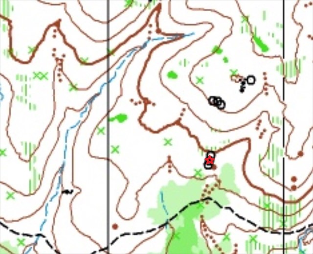
Navigate to the red star. From there, use the projection information found inside Confluence & Gullies to locate the cache.
Primer (intended directions with map reading tips along the way)
- From the Hemlock 2, Confluence & Gullies cache, navigate south to the summit (closed brown contour line).
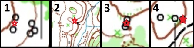
- Proceed to the target location. Note the north-south trend of the features at the target area.
- Stand on the middle one to make your projection.
- "Too far" feature: trail.
Some other notes:
- I have set the "not winter friendly" attribute solely due to difficulties with finding the piles of rocks in the snow.
- As you navigate, it might be prudent to come up with a point that is "too far". For example in the first cache, going over the ridge in search of the piles of rocks.
- Within the cache you will find the distance and bearing for the next cache in the series. Record this but don't take it with you.
- Have fun adventuring! However this is unkempt territory so be mindful of scorpions, gnats, and other nasty ninnies.
Links to caches:
 No night caching

Best Series 2016