Alligator Creek
Charlotte Harbor Area Series
The Alligator Creek/Charlotte Harbor Area Series of geocaches is intended to be a calm, even-keeled, and sometimes whimsical kayak paddle that can span over eleven-miles one-way.
Unlike our Shell Creek Series which can be extremely challenging, especially during the rainy season, this series can be considered the "Anti" Shell Creek.
Average paddles are:
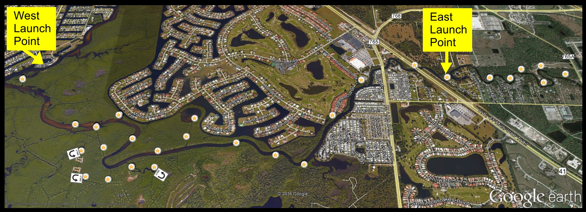
1.25 miles to the East of launch “A” at the [Pier 2 Peer P&G] geocache location. This is a great Beginner kayak/canoe trek.
You will paddle past the Indian Spring Cemetery, which is much higher than the creek, but you can still see the tops of some of the many cemetery monuments close to the creek. (also the location of one of our easy-n-enjoyable cemetery multi-caches)
Water varies little and it is a relatively peaceful waterway. This is a back-n-forth paddle so three-mile total round-trip.
8.0 miles between launch “A”- [Pier 2 Peer P&G] geocache location, and launch “B” – Riviera Marina Boat Launch Waypoint. There are several in-then-back-out-the-same-way mangroves, and we have marked these areas on the graphic so you can plan your route. This can be a true one-way if you arrange the logistics. Otherwise, the west-leg would be an arduous 16-mile round-trip. :o
This area of the Charlotte Harbor Preserve area is rich in history. Ponce de Leon, Native American Indians, and others have been in this area. Please use the Web to do some research, and of course visit the Charlotte Harbor Preserve website for more information, you’ll be pleasantly surprised.
Cache Notes:
- Logs are Waterproof Paper!
So even if soaked, whip-off, make your mark, return, and on-to-the-next!
- Cache containers are NOT meant to be removed in order to mark/log.
Permanently, yet ecologically secured, allowing expansion room.
- IF you get there, you will find-it. Hint are often in the cache name itself.
- These are mangroves, often canopied. We used three different GPS devices,
and had to shift around to get readings. Even at-that, once at Ground Zero
per GPS, then use your Geo-Senses; bam, it’s in your face.
- Very few are camo’d, but even those seemed to stand-out. Most-all are fitting
to the cache-name.
Lastly, if you have any questions before or after attempting, feel free to contact us!
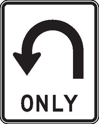
"U-Turn Only"
When you see this “U-Turn Only” sign on the provided map below,
it means that it is not practical to continue further.
Your map imagery may show a clear path, but in reality it is either impractical or
just flat-out impassable. So best to make your way out the way you entered.
Notably after reaching "SawSuch Links," "I'a Spit at'a You," and "Log It" caches.
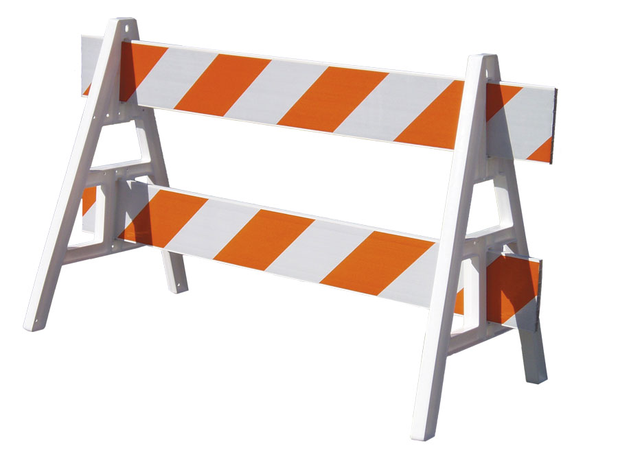
"Blocked Passage"
When you see this “barricaded” on the provided map below, it means that
although map imagery may show a possible waterway route, in-fact, there is not.
It indicates that between this and a nearby cache, there is no traversable "loop"
to get there and you will need to U-Turn and backtrack out.
Notably between "SawSuch Links" and "I'a Spit at'a You" caches.
This cache was placed with permission of the Florida Park Service.
For information about placing caches in THIS state park,
please contact the park office at 941-575-5816.
For further information about the Charlotte Harbor Preserve State Park:
www.floridastateparks.org/charlotteharbor