THE INFORMATION ON THE KISOK THAT THIS CACHE WAS BASED UPON HAS GONE MISSING AND DATA SERVICE IS SPOTTY AT BEST. IT IS RECOMMENDED THAT YOU SAVE THE PAGE AND "SPOILER" IMAGE OFFLINE.
Fantasy Canyon is an area composed of unique erosional features located about 27 miles south of Vernal, in northeastern Utah. Even though the area is only about 10 acres in size, it contains some of the most unique geologic features in the world. The site was officially documented by early explorer and paleontologist Earl Douglass, who recorded the area by other names such as "The Devil’s Playground” and “Hades Pit” He published photographs of this area (as seen below) in a 1909 publication called “The Columbian Magazine.”
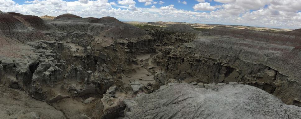
Fantasy Canyon as seen from above.
Geology
The rocks of Fantasy Canyon were deposited during the Eocene Epoch. The age of the rocks date around 38 to 50 million years ago. During the geologic period, the Uinta Basin was occupied by a large lake called Lake Uinta. The lake extended 120 miles west to Heber City, 30 miles east to Rangely, south to the Book Cliff Divide, north to the Unita Mountains, and was about a half mile deep.
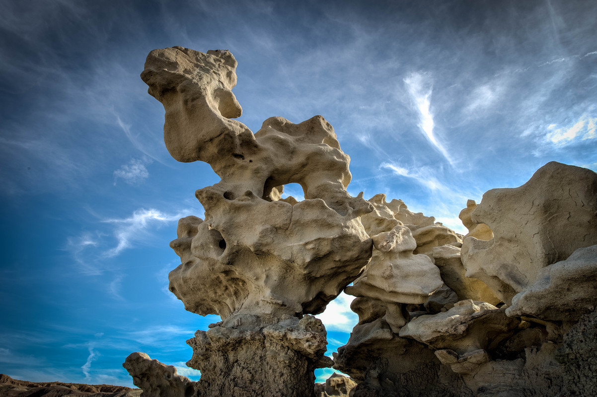
Fantasy Canyon is along the east shore of what was once Lake Uinta, where the sediments eroded from the surrounding high lands. Sediments were deposited and the once loose sands, silts, and clays were forged into sandstone and shale. Because of different rates of weathering, the more durable sandstone remained while the more easily weathered siltstone and shale washed away, yielding this spectacular scenery.
Today’s geologic formations of Fantasy Canyon will eventually give way to weather and then topple and erode into sand, but new formations will appear as the topsoil washes away. Because the delicate formations are so fragile the area is also referred to as “Nature’s China Shop.”
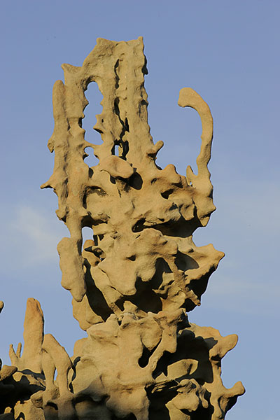
Left: The Tea Pot formation, once a recognizable landmark, is now sadly gone.
One of the most famous of these structures, as seen in the nearby photo to the left, was called the Tea Pot formation, and sadly several years ago it was found to be destroyed, with evidence that it may have been human caused. As such, please do your best to be careful and protective of this amazing area, and avoid doing anything that might destroy what has taken millions of years to create.
Mineralization
There are black ribbons of coal-like material along the small washes on the trail or as horizontal stripes in the rocks. This magnetic material is called magnetite (iron oxide). It is the only natural mineral which shows strong magnetism. Magnetite was named for Magnes, a Greek shepherd, who discovered the mineral on Mount Ida, Australia. He noted the nails of his shoes and the iron ferrule of his staff clung to a rock.
There are roughly inch-wide black vertical northwest – southeast running veins in the formations. This material is called "Gilsonite" (hydrocarbon), named after U.S. Marshall Samuel H. Gilson. Gilsonite was discovered in the early 1860’s, but it was not until the mid-1880’s that Gilson began to promote the mineral as a waterproof coating for wooden pilings, as an insulation for wire cable, and as a unique varnish. To learn more about the geology here, check out the following naerby earthcache: Fantasy Canyon.
Fossils
The Uinta formation is an important keeper of a portion of the fossil record for this area. It contains the widely scattered bones of creatures, mostly mammals, which roamed the Basin during the Eocene. Fossilized turtle shells are sometimes visible in the area.
Click here to download a map showing where Fantasy Canyon is located.
Click here to download a map showing where the various Fantasy Canyon formations are located.
Source: Adapted from http://www.blm.gov/ut, by josephaw
Cache Description
Your quest begins at the posted coordinates but you won't find the cache there.
You will find the cache at:
N 40 (Prowling Coyote).(Boxing Bear)(Camel)(Sunken Face)
W 109 (Diving Seal).(Rabbit)(Mickey Mouse)
(look for the information board at the post coordinates, that should get you started)
Update, June, 2023: When we placed this cache we had the impression that this kiosk had been here a long while and would stay so into reaonable perpetuity. Alas, we we've been proven wrong. You've come this far and shouldn't be taunted with an unworkable multi, so click on this image to get you going.
If you want to check the results of your puzzle, click here: geochecker