![[ITA]](https://imgproxy.geocaching.com/1a3c9db9e5c5118d2b76d964cb346e2cd715184a/687474703a2f2f7777772e7265616479746f7765622e69742f63616368652f666c61675f6974612e676966)
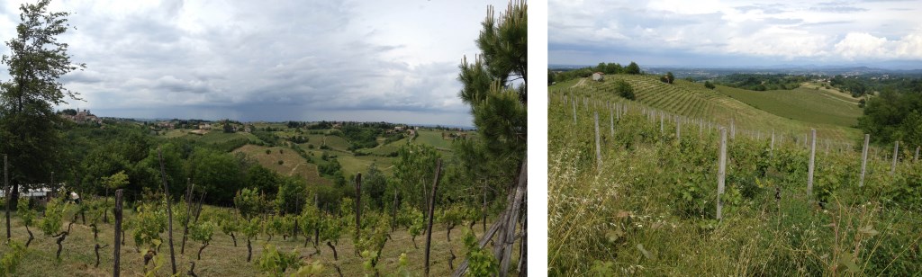
Questa passeggiata di circa 8 km offre vedute spettacolari su diversi paesi e colline dell'Alto Monferrato.
Se la giornata è limpida, è possibile ammirare le cime delle Alpi e spostare lo sguardo su decine di campanili, castelli e torrioni dei paesi limitrofi.
Il percorso si articola tutto su strade carrabili, in parte asfaltate e in parte sterrate.
E' possibile avvicinarsi al cache anche in auto, ma il consiglio, se si dispone di un paio d'ore, è quello di parcheggiare al punto segnalato e percorrere a piedi l'anello indicato nella cartina (vedi sezione Immagini), per ammirare al meglio il paesaggio circostante.
![[ENG]](https://imgproxy.geocaching.com/35bc09b5aea321af6eb87e00e5c41b3aee5f8ff3/687474703a2f2f7777772e7265616479746f7765622e69742f63616368652f666c61675f656e672e6a7067)
This path of approximately 8 kilometers is characterized by beautiful views of several villages and hills of the Alto Monferrato.
If the day is sunny and without haze, it is possible to see the Alps and to take a look at dozens of towers, bell towers and castles of the villages in the zone.
The path is on dirt and paved roads, mostly accessible to cars.
It is possible to approach the cache by car, but if you have a couple of hours, it is recommended to park the car at the Parking point and to walk along the ring depicted in the map (see Image section), to better admire the surrounding landscape.