The Keilor Plains is part of the greater Western Volcanic Plains which cover a large part of western Victoria and extend into south-eastern South Australia and are stated to be the third largest lava plains in the world. These landforms were created by the incision of the Jackson Creek into think lava flows that erupted about 2.5 to 2.8 million years ago during the Pleistocene Period. These lavas overlie steeply dipping Silurian sedimentary rocks.
Basalt is defined by its mineral content and texture, and physical descriptions without mineralogical context may be unreliable in some circumstances. Basalt is usually grey to black in colour, but sometimes rapidly weathers to brown or rust-red due to oxidation of its iron-rich minerals into rust. Although usually characterised as "dark", basaltic rocks exhibit a wide range of shading due to regional geochemical processes. Due to weathering or high concentrations of plagioclase, some basalts are quite light coloured, superficially resembling ryholite to untrained eyes. Basalt has a fine grained mineral texture due to the molten rock cooling too quickly for large mineral crystals to grow, although it is often porphytitic, containing the larger crystals formed prior to the extrusion that brought the lava to the surface, embedded in a finer-grained matrix.
If a lava flow cools relatively rapidly in the open air significant contraction forces build up. While a flow can shrink in the vertical dimension without fracturing, it can't easily accommodate shrinking in the horizontal direction unless cracks form, the extensive fracture network that develops results in the formation of columns. The topology of the lateral shapes of these columns can broadly be classed as a random cellular network. These structures are predominantly hexagonal in cross-section, but polygons with three to twelve or more sides can be observed. The size of the columns depends loosely on the rate of cooling; very rapid cooling may result in very small (<1 cm diameter) columns, while slow cooling is more likely to produce large columns.
When basalt erupts underwater or flows into the sea, contact with the water quenches the surface and the lava forms a distinctive pillow shape, through which the hot lava breaks to form another pillow. This "pillow" texture is very common in underwater basaltic flows and is diagnostic of an underwater eruption environment when found in ancient rocks. Pillows typically consist of a fine-grained core with a glassy crust and have radial jointing. The size of individual pillows varies from 10 cm up to several meters.
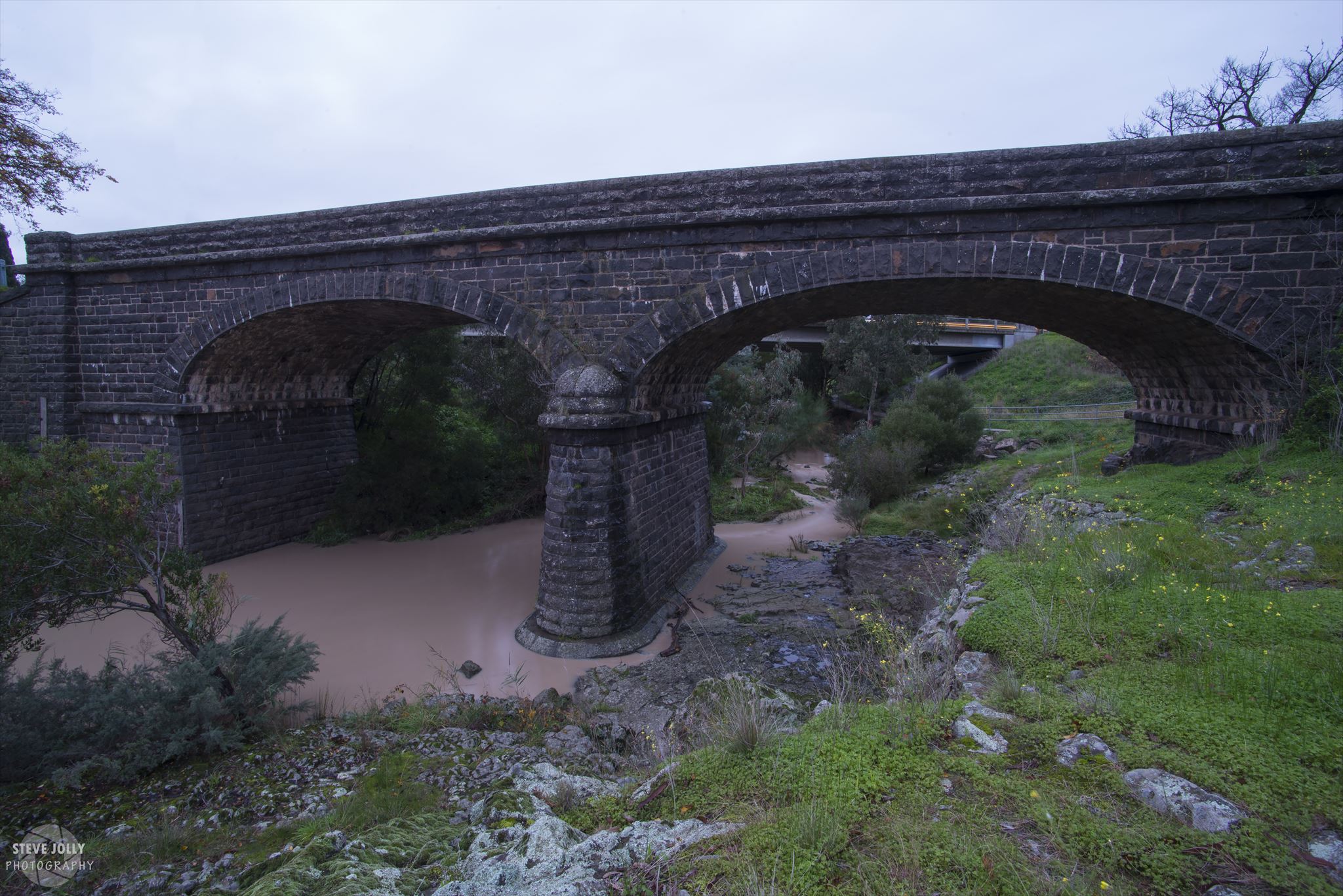
In order to log this Earthcache you need to email me with your answers to the following questions with the bridge to your back, looking at the small cliff along the waters edge just outside the edge of the photograph above.
Q1. What is the main colour of the Basalt?
Q2. Do you think this outcrop of Basalt cooled in open air or underwater? What brings you to this conclusion?
Q3. How does the Basalt at the coordinates differ from the Basalt under the bridge pylon on the right? (Looking from GZ)
Feel free to log this before emailing me, but logs with no corresponding answer email will be deleted