The main photo on the information board is an arial shot of the backwash in the 1930s. As you can see the area under water was considerably larger than today.
Tha map below explains a bit of the history.
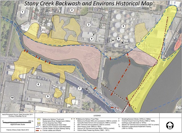
Now consult the board for a few numbers:
In the 18ABs, Stony Creek was an important route for labourers heading upstream to the quarries.
Lots of rail sidings were constructed and served numerous purposes throughout their FC years.
The original Stand of White Mangroves was totally destroyed in 1ED7. (by an ink spill in the creek!)
The final can be found at S37 49.ABC E144 53.DEF (nice area, but no seat!)