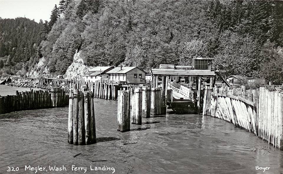
At the posted coordinates, you'll arrive at a small roadside pullout. Pause there for a moment -- no need to get out of your vehicles -- but gaze across the wide expanse of the mouth of the Columbia River to the Oregon shore. At the river's shoreline where you've stopped, you will see a large number of pilings sticking up out of the water, which are the remnants of one of the old ferry terminals that crossed the river before the nearby Megler Bridge was completed 50 years ago.
To determine your next waypoint:
- If the pilings you see are made of wood, travel to the Desdemona Sandbar waypoint, approximately N46° 12.833 W123° 51.677.
- If you think the pilings you see are made of something other than wood, get your eyes checked ASAP and travel to the Desdemona Sandbar waypoint anyway ... N46° 12.833 W123° 51.677.
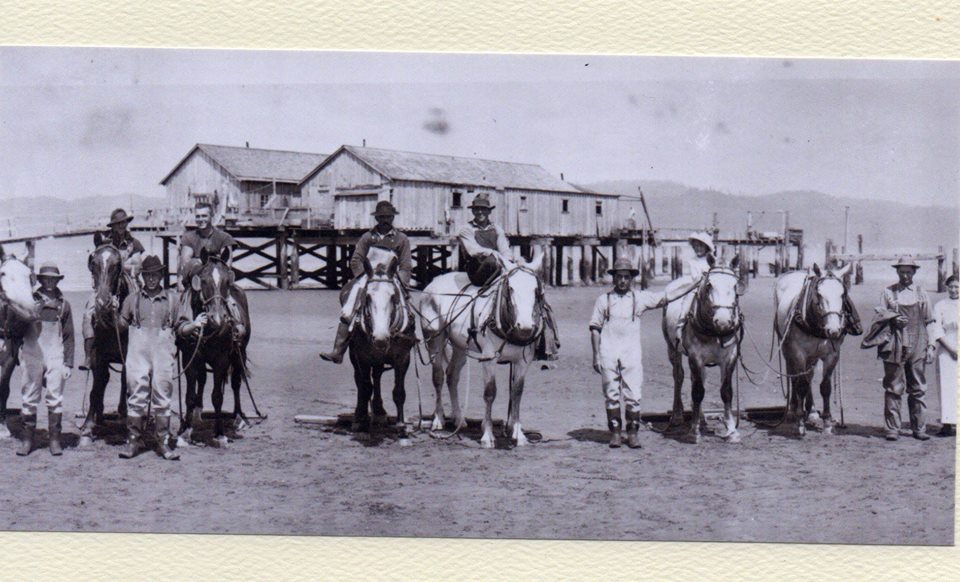
The Desdemona Sandbar waypoint will take you to the middle of the river on the bridge, heading towards the Oregon shore. DO NOT STOP YOUR CAR ON THE BRIDGE! As you approach the waypoint, look into the distance on both sides of the bridge. Except at very high tides, you will easily see a large quantity, literally hundreds of pilings sticking up out of the water about half a mile from the bridge. Those pilings are the remnants of horse stables that were used to house teams of horses and mules to pull salmon seine nets in the early 1900's. The photo shows one of the teams standing on the sandbar which is exposed at low tide, and the stables in the background which were located in the middle of the river.
To determine your next waypoint:
- If you see the pilings on the west side of the bridge (on your right heading towards Oregon), travel to the final waypoint at N46° 15.770 W123° 50.369.
- If you see the pilings on the east side of the bridge (on your left heading towards Oregon), you have a vivid imagination. Travel to the final location at N46° 15.770 W123° 50.369.
This small cove, known as Hungry Harbor, was named for the crew of a sailing vessel whose disabled boat drifted into the shallows, but before help could arrive they starved to death.
The cache is in a predictable location -- I hope you enjoyed the views and the history of this cache! Please replace the cache carefully so that it's not dislodged by winter storms.
In memory of Laurie Freeman aka geocache reviewer "Wizard of Ooze", aka geocacher Half-Canadian and Scooter the Wonder Dog. This geocache was originally placed by her for the enjoyment of the geocaching community.