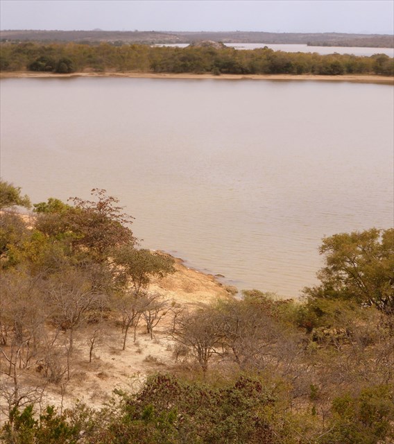
Kamburu Dam Vista
The cache, a customised bottle-tops micro, is hidden under bark pieces in a hole in the middle of an amazing twisted tree some 30m east(ish) of the highest view-point rocks.
To reach the cache location: To reach the cache location: take the A2 Nairobi-Thika road as far as Thika then exit on the slip road @ S1 02.416 E37 03.745 to join the A3 Garissa Road. Follow this for about 80km as far as the B7 junction at S1 05.884 E37 40.150. Turn left (north) onto the B7 and continue for about 36km to the cache location. Park anywhere convenient close to the cache and make your short way through the bush over towards the shady area below the view-point rocks.
Kamburu dam was the second major power station in Kenya after Kindaruma. Feasibility studies started in the 1960s and confirmed the viability of an upper reservoir for the Seven Forks cascade hydropower complex with a potential of 11 power plants – Masinga, Kamburu, Gitaru, Kindaruma, Kiambere, Karura, Mutonga, Low Grand Falls, Usheni, Adamson’s Falls and Kora.
The first five were developed between 1968 and 1988, while the others await implementation. The project took 7 years from feasibility studies to construction.
Kamburu Dam is the result of a man-made lake, with Tana river as its water source. It is one of the oldest dams in the country and has the 2nd major power station after Kindaruma. The dam also supports marine life for fish, hippos and crocodiles.
It is a rock-filled embankment dam straddling the border of Embu and Machakos Counties. Its primary purpose is hydroelectric power generation and it supports a 93 MWe 3-unit power station. Construction on the dam began in 1971 and it was completed in 1975. The power station was commissioned the same year. US$23 million of the US$47 million project cost was provided by the World Bank. The power station is operated by Kenya Electricity Generating Company (KenGen) and is part of the Seven Forks Project.
The 52m tall and 730m long dam creates a reservoir with a storage capacity of 123,000,000 m3. The power station is located underground just below the left toe and contains three 31 MW Francis turbine-generators. The difference in elevation between the reservoir and power station affords a net hydraulic head of 82m. Water discharged from the power station travels down a 3,040m long tailrace tunnel before reaching the Tana at Gitaru Reservoir.
See here for an interesting abstract on the effect of Masinga and Kamburu dam levels on fishes and fisheries.
See here for an article on the increased risk of malaria associated with dams.