
ITALIANO
In tutta la Sicilia si estende la zona di collisione delle placche africana ed eurasiatica tettoniche. Nel corso di sedimentazione della storia del movimento della Terra alternati a fasi di costruzione di montagna e attività vulcanica. Nonostante la complessità geologica può essere la più grande isola del Mediterraneo diviso in tre zone paesaggistiche:
(1) corre parallela alla costa settentrionale in continuazione del calabrese dell'Appennino una catena montuosa pieghevole, composto essenzialmente di calcare resistivo, pietre di quarzo e rocce cristalline.
(2) Nel sud chiude gran parte dell'isola occupare un paese collinare, formata anche da sedimenti marini alzate e evaporiti come il sale, gesso e zolfo.
(3) Il lime altopiano Monti Iblei nel sud-est è una parte sollevata della placca africana, che non è stato incluso nella circonvoluzione. Le lave antiche Sicilia si trovano sulla altopiano calcareo dei Monti Iblei. L'alta 986 m Monte Lauro è il residuo di un vulcano sottomarino, la cui attività è durata fino all'inizio del Pleistocene (2 milioni di anni B.P.). Sulle pendici del Monte Lauro sorge dell'Anapo, quindi, la ghiaia di basalto scuro brillante calcare detriti del letto del fiume.
Fonte: http://www.walksicily.de/natur/geologie.html
Il Monti Iblei è attraversato da profonde gole. Uno di questi canyon è la gola Anapo, in provincia di Siracusa è stato quello che ha formato il fiume omonimo Anapo.
Questo canyon è anche la necropoli di Pantalica, che comprende più di 5.000 tombe a camera. 2005 l'UNESCO ha dichiarato la Necropoli di Pantalica Siracusa insieme a Patrimonio Mondiale.
Questo Eartcache conduce alla grotta dei pipistrelli, una grotta carsica nella gola dell'Anapo.
Che cosa è carsico?
Sotto Carso si riferisce a morfologie geologia sotterranee (grotte carsiche) e morfologie fuori terra (superficie del Carso) in rocce carbonatiche (compresi solfato, rocce arenarie di sale e / quarziti) causata principalmente dalla soluzione e agenti atmosferici acido carbonico.
Come sono grotte?
Calcare è attraversato da numerose fratture e le articolazioni, dove l'acqua di superficie filtra rapidamente. Questo ha assorbito anidride carbonica dall'aria e viene convertito in anidride carbonica. L'acqua gassata può sciogliere in pietra calcarea sotterraneo. Fessure e crepe sono in aumento nel corso del tempo. Alle intersezioni di fratture e giunti e nell'area della falda freatica, la soluzione di calce è particolarmente efficace. Ha creato cavità sotterranee e grotte. L'erosione dell'acqua che scorre sotterranea aumenta le cavità. La falda acquifera sta cadendo sempre più. Infine, un vasto sistema di grotte che spesso si estende su più forme pavimenti.
Veniamo ora alle domande:
Parcheggiare l'auto alle coordinate specificate. Vai cartello alla grotta (WP01 - N 37 ° 08.473 E 015 ° 01.805).
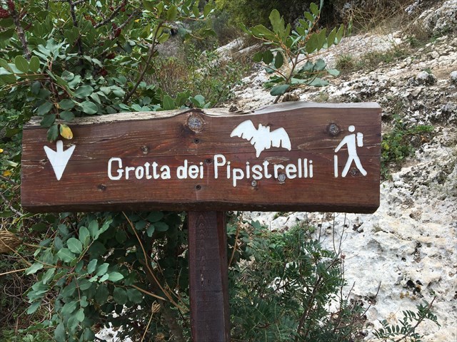
Controlla la grotta dei pipistrelli e fare attenzione. L'accesso alla grotta dei pipistrelli è ripida e può essere scivoloso sul bagnato.
Se siete nella grotta, guarda lì, le rocce più da vicino.
1) Quale roccia della grotta e il canyon è (vedi elenco) e descrivere con parole proprie la superficie e il colore della roccia?
2) Brevemente spiegare come possono sorgere grotte.
3) Facoltativo - Potete allegare una vostra foto o del vostro GPS – nessun obbligo di registrazione.
Vi prego di inviare le risposte al mio GC-Profil. Potete registrarvi immediatamente senza aspettare la mia autorizzazione. Sarete contattati nel caso le vostre risposte non fossero esatte.
(Questo è Google Translate italiano. Se non è corretto per favore fatemelo sapere)

DEUTSCH
Quer durch Sizilien verläuft die Kollisionszone von Afrikanischer und Eurasischer Kontinentalplatte. Im Laufe der bewegten Erdgeschichte wechselten sich Sedimentationsprozesse mit Phasen der Gebirgsbildung und vulkanischer Tätigkeit ab. Bei aller geologischen Komplexität lässt sich die größte Mittelmeerinsel in drei Landschaftszonen gliedern:
(1) Parallel zur Nordküste verläuft in Fortsetzung des Kalabrischen Apennin eine Faltengebirgskette, im Wesentlichen aus widerständigen Kalken, Quarzsandsteinen und kristallinen Gesteinen aufgebaut.
(2) Im Süden schließt sich, einen Großteil der Insel einnehmend, ein Hügelland an, ebenfalls gebildet von emporgehobenen Meeressedimenten und Evaporiten wie Salz, Gips und Schwefel.
(3) Das Kalktafelland der Monti Iblei im Südosten ist ein empor gehobener Teil der Afrikanischen Platte, der nicht in die Faltung mit einbezogen wurde. Die ältesten Laven Siziliens liegen dem Kalksteinplateau der Monti Iblei auf. Der 986 m hohe Monte Lauro ist der Rest eines untermeerischen Vulkans, dessen Aktivität bis ins frühe Pleistozän (2 Mio. Jahre B.P.) andauerte. An den Hängen des Monte Lauro entspringt der Anapo, daher die dunklen basaltischen Schotter im hellen Kalkgeröll des Flussbettes.
Quelle: http://www.walksicily.de/natur/geologie.html
Der Monti Iblei, auch Hybläische Berge genannt, wird von tiefen Schluchten durchzogen.
Einer dieser Schluchten ist die Anapo Schlucht in der Provinz von Syrakus welche vom gleichnamigen Fluss Anapo geformt wurde.
In dieser Schlucht befindet sich auch die Nekropole von Pantalica welche mehr als 5000 Kammergräber umfasst. 2005 erklärte die UNESCO die Nekropolis von Pantalica zusammen mit Syrakus zum Weltkulturerbe.
Dieser Eartcache führt dich zur Fledermaushöhle, eine Karsthöhle in der Anapo Schlucht.
Was ist Karst?
Unter Karst versteht man in der Geologie unterirdische Geländeformen (Karsthöhlen) und oberirdische Geländeformen (Oberflächenkarst) in Karbonatgesteinen (auch in Sulfat-, Salzgesteinen und Sandsteinen / Quarziten), die vorwiegend durch Lösungs- und Kohlensäureverwitterung entstanden sind.
Wie entstehen Karsthöhlen?
Kalkgestein ist von zahlreichen Spalten und Klüften durchzogen, in denen das Oberflächenwasser schnell versickert. Dieses hat aus der Luft Kohlenstoffdioxid aufgenommen und in Kohlensäure umgewandelt. Das kohlensäurehaltige Wasser kann im Untergrund Kalk lösen. Spalten und Klüfte werden im Laufe der Zeit immer größer. An Kreuzungen von Spalten und Klüften und im Bereich des Grundwasserspiegels ist die Kalklösung besonders wirksam. Es entstehen unterirdische Hohlräume und Höhlen. Die Erosion des unterirdisch fließenden Wassers vergrößert die Hohlräume. Der Grundwasserspiegel sinkt immer weiter ab. Schließlich bildet sich ein weit verzweigtes Höhlensystem, das sich oft über mehrere Stockwerke erstreckt.
Nun zu den Fragen:
Parke dein Cachemobil bei den angegebenen Koordinaten. Gehe nun den Pfad entlang bis zum Wegweiser zur Höhle (WP01 - N 37° 08.473 E 015° 01.805).
Besuche die Fledermaushöhle und sei vorsichtig beim Abstieg zur Höhle. Der Zugang zur Fledermaushöhle erfolgt über steile in den Fels gehauenen Stufen die bei Nässe sehr rutschig sein können.
Wenn du bei der Höhle bist, sieh dir dort die Felsen genauer an.
1) Aus welchen Gestein besteht die Höhle bzw. die Schlucht (siehe Listing) und beschreibe mit eigenen Worten die Oberfläche und Farben des Gesteins?
2) Erkläre kurz wie Karsthöhlen entstehen können.
3) Optional kannst du gerne ein Foto von dir und/oder deinem GPS an deinen Log anhängen – dies ist aber keine Logbedingung
Sende mir Deine Antworten über mein GC-Profil. Danach kannst Du sofort loggen. Du brauchst meine Logerlaubnis nicht abwarten. Sollten was falsch sein melde ich mich.

ENGLISH
Across Sicily, the collision zone of the African and Eurasian continental plate runs. In the course of the moving earth history sedimentation processes with phases of the mountain formation and volcanic activity took place. With all its geological complexity, the largest Mediterranean island can be divided into three landscape zones:
(1) Parallel to the north coast, a continuation of the Calabrian Apennine, a chain of wrinkles, essentially composed of resistive limestones, quartz sand stones and crystalline rocks.
(2) In the south, occupying a large part of the island, a hill adjoining, likewise formed by elevated sea eminents and evaporites like salt, plaster, and sulfur.
(3) The limestone plateau of the Monti Iblei in the southeast is an uplifted part of the African plate, which was not included in the fold. The oldest lava in Sicily is situated on the limestone plateau of the Monti Iblei. The 986 m high Monte Lauro is the remnant of an underwater volcano whose activity lasted until the early Pleistocene (2 million years B.P.). On the slopes of Monte Lauro is the Anapo, hence the dark basaltic gravel in the light limestone of the riverbed.
Source: http://www.walksicily.de/natur/geologie.html
The Monti Iblei, also called the Hyblean Mountains, is crossed by deep ravines.
One of these gorges is the Anapo Gorge in the province of Syracuse, which was formed by the Anapo river.
In this gorge is also the necropolis of Pantalica, which includes more than 5000 chamber tombs. In 2005, UNESCO declared the Necropolis of Pantalica, together with Syracuse, a World Cultural Heritage.
This eartache leads you to the Batcave, a karst cave in the Anapo Gorge.
What is karst?
Karst is understood to mean underground terrain forms (karst caves) and surface formations (surface karst) in carbonate rocks (also in sulfate, salt rocks and sandstones / quartzites), which are predominantly caused by the formation of solvents and carbonic acid.
How do karst caves arise?
Lime rock is traversed by numerous crevices and gaps in which the surface water quickly seeps away. This has absorbed carbon dioxide from the air and converted into carbonic acid. The carbonated water can dissolve lime in the subsoil. Columns and gaps are getting bigger and bigger. The lime solution is especially effective at crossings of gaps and gaps and in the area of the groundwater level. Underground cavities and caves are created. The erosion of the underground water increases the cavities. The groundwater level drops further and further. Finally, a wide-bodied cave system forms, which often extends over several floors.
Now to the questions:
Park your cachemobile at the specified coordinates. Now go down the path to the signpost to the cave (WP01 - N 37 ° 08,473 E 015 ° 01,805).
Check out the bat cave and be careful on the way down to the cave. Access to the bat cave is via steep steps carved into the rock that can be very slippery when wet.
If you're in the cave, look there, the rocks more closely.
1) Which rock is the cave and the canyon (see listing) and describe in their own words the surface and color of the rock?
2) Explain briefly how karst caves can arise.
3) Optional you can upload a picture of you and/or your GPS unit at the site, but this is not a log requirement.
Send me your answers on my GC profile. Then you can login immediately. You need not wait for my log permission. Should be something wrong I will contact you.