Wisconsin is made up of 72 counties, this cache is focused on Bayfield County. Bayfield County is a county located in the U.S. state of Wisconsin on the Canada–United States border. As of the 2010 census, the population was 15,014. Its county seat is Washburn. The county was created in 1845 and organized in 1850. Here are a few stats about Bayfield County, courtesy of Wikipedia. You can learn more about Bayfield county at: https://en.wikipedia.org/wiki/Bayfield_County,_Wisconsin
This county's oldest geocache is GC15AE Railroad pass, placed by James.
You will find this cache at N44 32.ABC W90 05.DEF
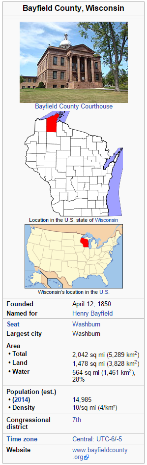
A: There are 1,4A8 square miles of land in the county.
B: Originally, in 18B8 it was named La Pointe County, Wisconsin.
C: The county was renamed Bayfield County on April 12, 18C6.
D: The population in 2014 is 14,D85.
E: In 1910, the population was 15,E87.
F: WI's congressional district.
SOURCE: Most of the information on this page was obtained from Wikipedia's page about this Wisconsin county.
CHECK SUM: A+B+C=17 D+E+F=25