Go to the Posted Coordinates and answer the following questions. Send the answers to these questions to my profile!:
1. What type of Stratified rock makes up "The Point"?
2. What is a Marine Terrace?
3. Where locally can you find evidence of an Ice Age that is older then the last ice age?
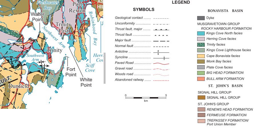
Trinity Harbour owes its origin to geological processes - namely faulting - that occurred hundreds of millions of years ago and it's shape is the result of the intersection of the ancient north-south and northwest-southeast fault systems that form the three arms (northwest, Southwest and West arms). The Fracturing and crushing of the rocks as they slip past each other weakened the rocks competency and allowed for perforation erosion or scouring by glaciers in the relatively recent geologic past, and by rivers and the sea ever since. Flooding by the sea formed the arms of the harbour.
However the land that forms Fort Point consists of a core of near vertical dipping layers of sandstone and conglomerate that are quite resistant to erosion and weathering. These vertical beds also trend parallel to the faults and thus escaped their destructive affects.
This piece of land, Fort Point, now forms a natural barrier to the sea, and a natural breakwater for Trinity Harbour. It also provided a natural and strategic place for military fortifications for the protection the Trinity in the 18th and 19th centuries.