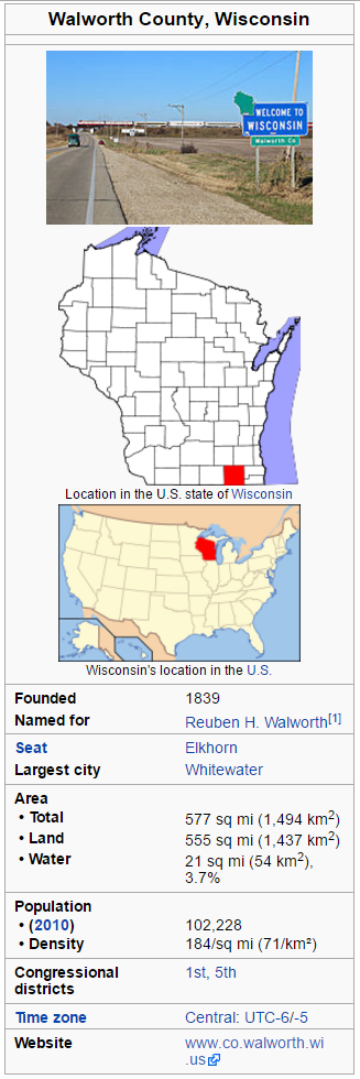
Wisconsin is made up of 72 counties, this cache is focused on Walworth county. Walworth County is a county located in the U.S. state of Wisconsin. As of the 2010 census, the population was 102,228. Its county seat is Elkhorn. The county was created in 1836 from Wisconsin Territory and organized in 1839. It is named for Reuben H. Walworth. Walworth County comprises the Whitewater-Elkhorn, WI Micropolitan Statistical Area and is included in the Milwaukee-Racine-Waukesha, WI Combined Statistical Area. Lake Geneva, the University of Wisconsin-Whitewater, and Alpine Valley Resort, and Music Theatre are located in Walworth County. Here are a few stats about Walworth County, courtesy of Wikipedia. You can learn more about Walworth county at: https://en.wikipedia.org/wiki/Walworth_County,_Wisconsin
This county's oldest geocache is GC5235 Water's Edge, placed by Team Cachebarr.
You will find this cache at N44 33.ABC W90 03.DEF
A: The interstate that goes through this county is I-4A.
B: The number of coins that the WGA has minted multiplied by zero.
C: According to the U.S. Census Bureau, the county has a total area of 5C7 square miles.
D: East Troy Municipal Airport (FAA LID: 5DC), serves the county and surrounding communities.
E & F: This county's oldest geocache is GC52EF Water's Edge.
SOURCE: Most of the information on this page was obtained from Wikipedia's page about this Wisconsin county.
CHECK SUM: A+B+C=10 D+E+F=15