Enjoyed a wonderful motorcycle ride today for my Veteran's Day.
Happy Veterans day to all who have not returned from their conflict. For the ones's who have paid the price for freedom with their lives. May they never be forgotten. POW/MIA. Return with honor.
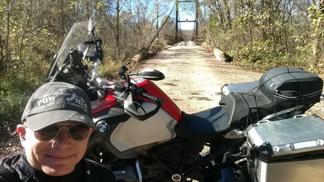
I spent the day on plenty of dirt on a route I found online.
Left Fort Leonard Wood on my 2016 BMW R1200GS Adventure and headed toward Dixon and then turned off on miles and miles of wonderful dirt (with a few sections of climbs with really loose rock and a curve for a bonus...still don't care for those)
Ended up over at Swinging Bridges and then made the ending Lake of the Ozarks State Park where I found a few geocaches and took more highway back home, but still threw in some dirt when I could. A great day!
When I got to this spot I knew that it should be shared with the geocaching community. Make sure to cross over the bridge. There is an access area to the river and areas to camp.
Easy geocache, just upped the terrain because of the access roads. Do not attempt in times of flooding. If you are standing where I am in this picture, you are very close!
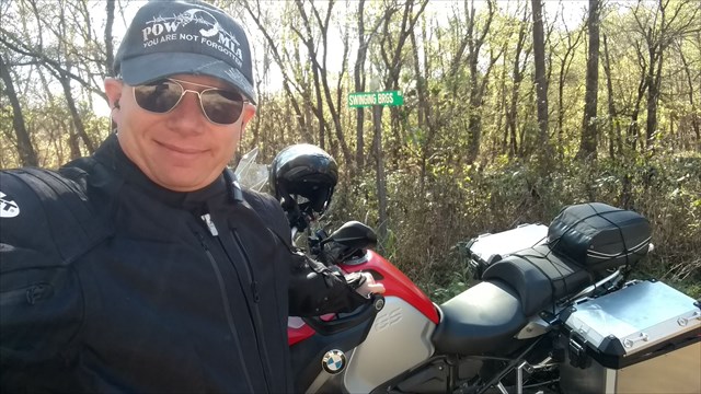
Off the beaten path, but definitely worth exploring.
The below is information about the bridge with some really nice photos:
https://bridgehunter.com/mo/miller/grand/
"Suspension bridge over Grand Auglaize Creek on Swinging Bridges Road (Lake Road 42-18) southwest of Brumley
Location" in Miller County, Missouri.
"Built 1922 by Joseph Dice"
"Design: Wire suspension
Dimensions
Length of largest span: 414.0 ft.
Total length: 500.0 ft.
Deck width: 12.1 ft.
Vertical clearance above deck: 13.5 ft.
Recognition
Eligible for the National Register of Historic Places"
![Grand Auglaize Swining Bridge]()