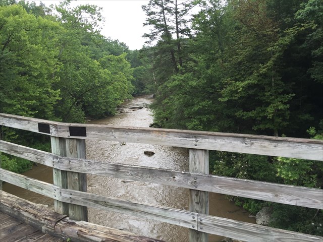
The Guest River Gorge was formed by Uniformitarianism.
This means that the gorge is formed gradually over a very long period of time, usually thousands of years. There are several factors that lead to this formation. Plate tectonics, limestone, and the powerful water flow all play a factor in gradually creating these physical features. The movement and change of the earth’s surface is known as plate tectonics. The movement caused the gradual uplifting of ground and the presence of limestone in the rock also facilitated the creation of this gorge. The limestone is much easier to erode than other rocks as a result of its solubility in water and also the fact that limestone is very sensitive to acids and water is usually slightly acidic.
The motion of the Guest River is the motion that resulted in erosion, the rivers ability to cut into its channel and carry away sediment. Most of the river's energy was spent overcoming friction in passing over the river channel and its obstacles and is converted into heat. Only 5 percent or less of the river's energy was left and available for the work of abrasion and transportation; in short, the cutting of the gorge.
Geologic uplift was also a factor in the creation of this gorge. Southwest Virginia sits on a fault line called the Russell Fork Fault. In geology, uplift refers to a vertical movement of the Earth's crust and is one of the primary factors in the formation of mountains and other prominent landscape features.
The Gorge itself is a spectacular chasm carved into the southern face of Stone Mountain by the Guest River, a classic Appalachian headwater stream arising high on the Appalachian Plateau.
Elevation: 1975 ft., This is a 5.8-mile trail built upon an old railroad grade. The trail follows the Guest River as it meanders through 8 branches and creeks and terminates at the Guest River’s confluence with the Clinch River. The first 0.3-miles is handicap accessible, and the remainder of the trail is accessible to hikers and bicyclists.
This scenic trail passes through riparian woodlands, creekside bottoms, 300-million year old cliff lines and rock outcrops (including Pennsylvanian sandstone in Lee Formation-323 million years old(river bottom and side slopes) and Norton Formation-317 years old (bedrock)), and remnants of the railway that once ran through this region to haul locally-mined coal and other minerals.
The Gorge’s high cliffs and rugged class IV-V rapids take on a wilderness feel that is hard to find in the Cumberland Mountains. Black bears are not an uncommon sight deep within the Gorge, and numerous side canyons and their associated waterfalls beg for further exploration. Large segments of the lip of the Gorge dislodged over time through the constant eroding power of water and the pull of gravity.
Some of these boulders have even tumbled their way down into the actual riverbed itself, forming dramatic rock gardens that the Guest braids through on its way downstream. The thought of such a large mass of rock breaking free and tumbling down into the Gorge is enough to give a person pause as they wind through its depths.
The 30-mile river flows past Coeburn, enters the gorge, and cascades over ledges and around huge boulders beneath sheer canyon walls. The Guest flows out of the gorge and empties into the Clinch River where Wise, Scott and Russell counties meet.
For the most part, the gorge remains as nature created it.
Permission for this Earth Cache was given by Ranger George Herschel, of the Clinch Ranger District.
From the information provided at the kiosk, the Earthcache description and your observations- Please email me the answers to the following questions:
1. In your observation what evidence do you see that the gorge was formed through uniformitarianism?
2.Estimate the height of the tallest cliff you see at gz.
You are welcome to post photos of your visit to the site, but this is optional and not part of the logging requirements.
FTF HONORS GO TO ???
| I have earned GSA's highest level: |
 |