This cache replaces a multi that was archived called the "Manukau Timber Company Heritage Trail".
You have the choice of going straight to the cache, or you can take this leisurely trail (0.9 km, 20 minutes) which starts at the carpark beside the Huia Settlers Museum.
Waypoint 1 : Huia Settlers Museum (parking co-ordinates)
These steep hills, where once crowded with mighty Kauri trees. Then in the 1800's the hills where stripped almost bare by settlers with "timber fever". Waitakere Kauri forest where like gold to settlers with ambition.
John Gibbons took out a timber licence for the west side of the Huia Valley in 1854 and developed two mills in this area - one at the mouth of the Huia Stream and the other at the mouth of the Karamatura Stream.
By 1867 most of the easily accessible trees in the Karamatura valley had been milled by the Gibbons family.
What remained was milled in the early 1890's by the Manukau Timber Company.
Follow the fenceline to the foreshore (Wp 2)
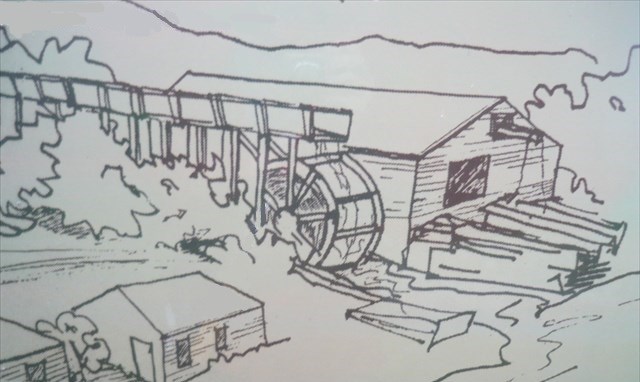
Waypoint 2 : Water wheel - Niagara Falls ( S 37° 00.281 E 174° 33.866 )
The Gibbons Timber Mill (located just across the stream) was powered by a gigantic water wheel, 8m in diameter. The effect of water gushing over it, was likened to the Niagara Falls, and so the mill was named.
You are standing where some mill workers cottages stood. The large Macrocarpa and Poplar trees around here date from the timber milling era.
Kauri trees where often cut to order. Logs for building where usually cut to 3-5m lengths. The Gibbons specialty was cutting long planks, and other timber for boat building.
Go thru the gate into the paddock, look for orange trail markers on your left, climb up the hill, until you see another gate. ( S 37° 00.356 E 174° 33.860 ) Go down the path to the beach and the mill foundations.
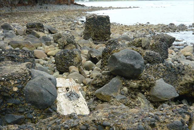
Waypoint 3 : Manukau Timber Mill Foundations ( S 37° 00.385 E 174° 33.853 )
Here are the remains of the Manukau Timber Mill. Logs where bought downstream to the mill, and where 'stored' behind a a boom. They where then hauled up a ramp onto the saw bench. A steam engine drove the saw blade. Cut timber was then transported via a tramway to a ship waiting at the wharf.
Walk to (Wp 4) and the track entrance.
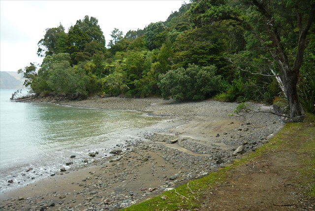
Waypoint 4 : Hinge Bay ( S 37° 00.396 E 174° 33.831 )
A series of buildings where constructed by the Manukau Timber Company - a managers house (1892), workers cottages, cook house and school (1893).
Straight ahead, hidden by the trees, are all that remains of the buildings: the school (Huia Lodge) and managers house (Hinge House). Please respect the hirers privacy, as they are part of the Huia Regional Park.
The school was built for 60 pupils. After the mill closed (1894), families moved away, and eventually the school had to close too.
In 1932 William Hinge purchased 32 hectares, for farming, and the Bay and house are now named after his family.
Later the Anglican Church, purchased the land, running camps until 1989, when it was then sold to the Auckland Regional Council.
To find out more about hiring either Huia Lodge or the Kiwanis Lodge, check the Auckland Council website for details.
Walk up the path, take a right turn to arrive back on Huia Road. Remember to find the cache as you walk past.
Walk to (WP5) by following the road, or go through the small gate and cross the paddock, to the carpark, then cross Huia Road.
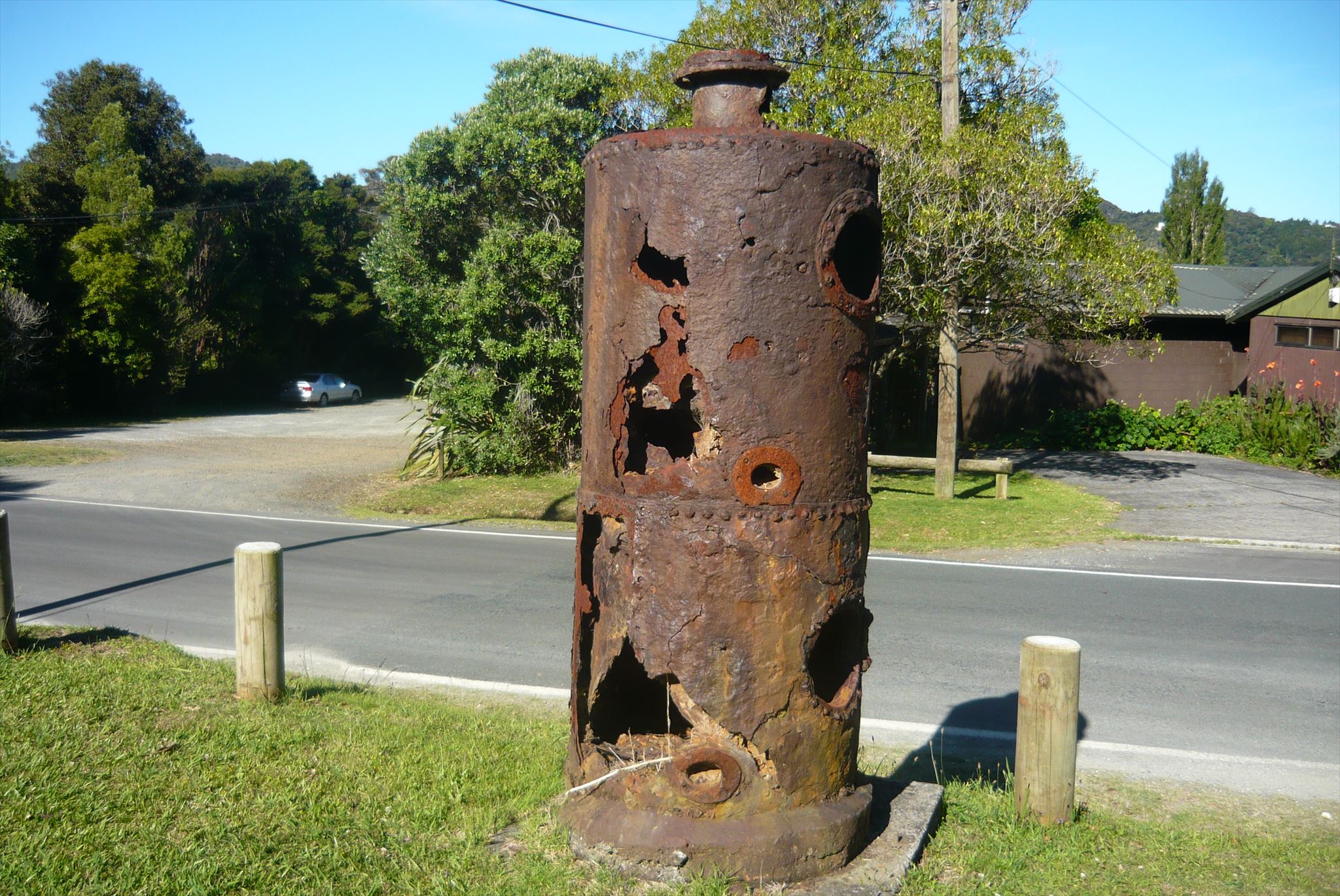
Waypoint 5 : The Boiler ( S 37° 00.289 E 174° 33.721 )
This is a relic of the teatree firewood trade, that existed until the 1940's.
It is part of a steam engine used by Thomas Fletcher to drive a saw bench at Sawyers Point on the Huia coastline about 1910.
Eventually it was recovered from Big Huia creek in 1988, where it had lain since the 1920's.
This loop tour of some of the Huia history has ended, you can cross the road to your vehicle.