GC70XHT ▼
Size: (small)
Related Web Page
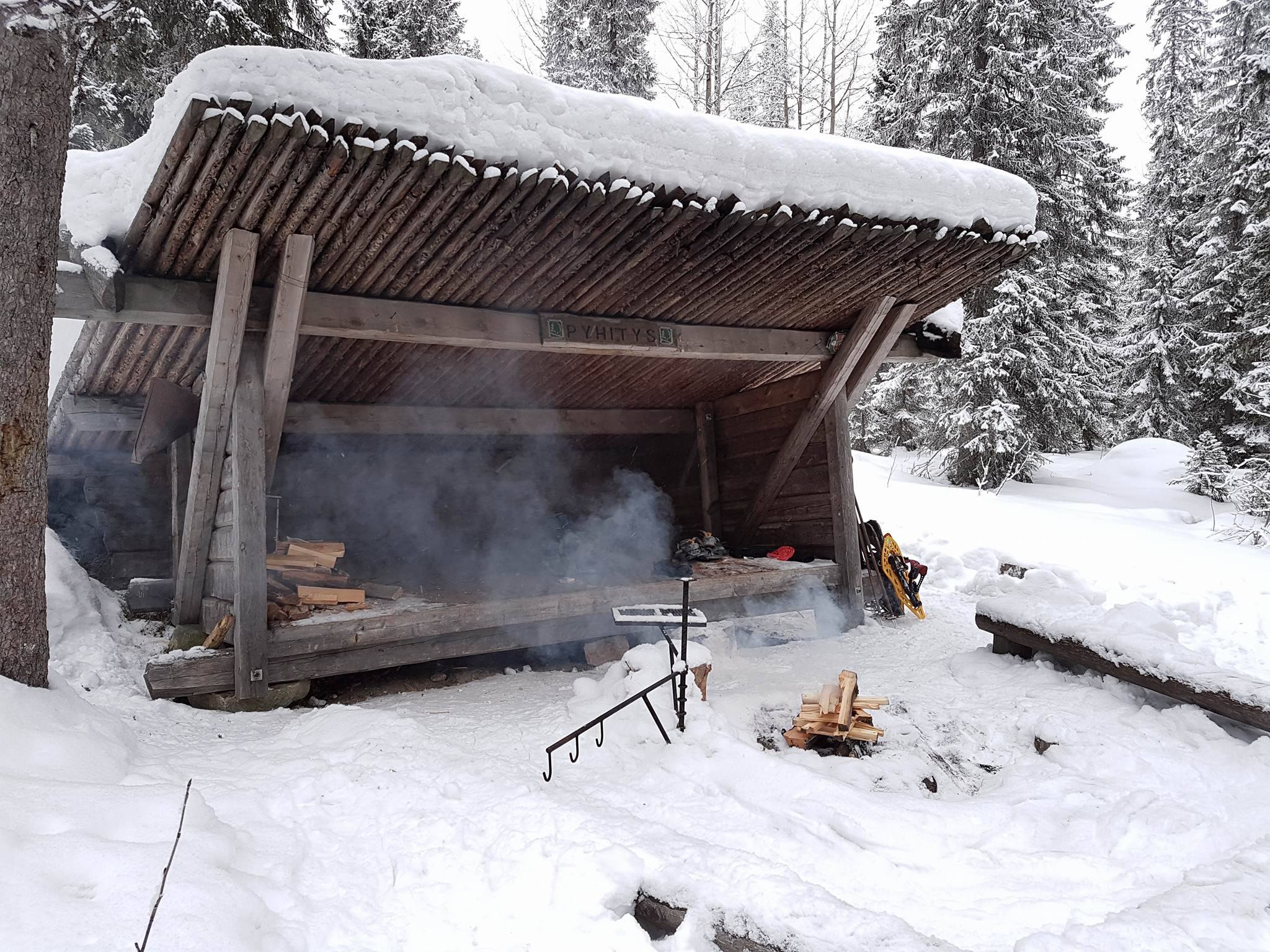
Syötteen kansallispuiston korkein vaara, Pyhitys, kohoaa 422m korkeuteen. Kesäparkkipaikalta lähtee hiukan alle 2km pituinen, keltaisella merkitty, vaellusreitti vaaran huipulle. Puolivälissä reittiä sijaitsee Metsähallituksen ylläpitämä laavu. Laavulla on nuotiopaikka, polttopuuta ja käymälä.
Laavulta kannattaa jatkaa matkaa Pyhityksen huipulle nauttimaan upeista maisemista. Samalla kannattaa vierailla siellä olevalla geokätköllä: Pyhitysvaara. Huomioithan, että reitti nousee 160m puolentoista kilometrin matkalla.
Kätkö on kansallispuistossa, joten Metsähallituksen ohjeiden mukaisesti siitä on ilmoitettu Pohjanmaan luontopalveluihin Syötteen luontokeskukseen. Lisätietoa Syötteen kansallispuistosta löytyy verkkosivuilta www.luontoon.fi/syote. Huomioithan kansallispuiston säädökset alueella liikkuessasi, mm. viet tuomasi roskat mukanasi ja et liiku alueella moottoriajoneuvoilla.
Pyhitys is the highest hill in the national park of Syöte. It's height is 422m. There is about 2 km long hiking path from parking place to the top of the hill. The path is marked with yellow marks. The lean-to shelter is in halfway on the path. It's for common use with a campfire site, firewood provisions and a dry toilet.
From the lean-to shelter there is quite steep path to the summit of the hill, but it's worth of visiting. At the top of the hill you can see quite beautiful view. You can also visit a geocache there: Pyhitysvaara.
The cache is in a national park. Please, remember the rules of national parks: for example don't use motor vechiles and take your litter back with you. More information on the national park of Syöte can be found in the web pages www.nationalparks.fi/syotevisitorcentre.
Additional Hints (Decrypt)
Decryption Key
A|B|C|D|E|F|G|H|I|J|K|L|M ------------------------- N|O|P|Q|R|S|T|U|V|W|X|Y|Z
(letter above equals below, and vice versa)
What are Attributes?
Advertising with Us
You'll collect a digital Treasure from one of these collections when you find and log this geocache: