Barren Fork River
The Barren Fork (sometimes referred to as the Barren Fork River) is a 23.4-mile-long tributary of the Collins River in the U.S. state of Tennessee. Via the Collins River, the Caney Fork, and the Cumberland and Ohio rivers, it is part of the Mississippi River watershed. The Barren Fork rises in western Warren County, Tennessee. It is formed from the confluence of its north and south prongs, which join near the tiny community of Trousdale. Its component streams and their tributaries drain much of the eastern portions of Cannon County and Coffee County. The stream flows generally from west to east until it reaches the town of McMinnville, county seat of Warren County. From there it turns in a more northeasterly direction. From this point it is less than 5 linear miles to the mouth of the Barren Fork into the Collins River, but considerably longer by the meandering course taken by the stream in its lower reaches. Near downtown McMinnville is a dam formerly utilized by the city as an electric power source; it was supplanted by the Tennessee Valley Authority system, as the small amount (by modern standards) of electricity it was capable of producing makes it impracticable to man and maintain by modern standards. The Barren Fork River is named for the "Barrens" area of Middle Tennessee. This area comprises much of Coffee County, western Warren County, and southeastern Cannon County. The area was first named this by the early settlers, who were surprised to find a largely unforested area in the midst of what was generally a dense hardwood forest surrounding it. Several theories have been suggested as to its origin. The area is somewhat swampy, however; it is too moist for many types of hardwood trees that cannot survive long periods of "wet feet". It is suggested that it was cleared by Native Americans, in part using fire, so that the resulting open area would improve grazing conditions for elk, deer, and buffalo and thus improve hunting, and that they, like their white successors, also used the area for agriculture. Since only a limited number of native hardwood trees could grow in the area, it was relatively easy for the area to remain cleared once it had initially had much of its woody vegetation removed.
Collins River
The Collins River is a 67-mile-long stream in the east-central portion of Middle Tennessee in the United States. It is a tributary of the Caney Fork, and is part of the Cumberland, Ohio and Mississippi watersheds. The river drains the scenic Savage Gulf area, located just below the river's source, and empties into Great Falls Lake at Rock Island State Park. The Collins River passes through Grundy and Warren counties. McMinnville, Altamont, Gruetli-Laager and Beersheba Springs are among the communities located within its watershed. The Savage Gulf section of the Collins River has been designated a "scenic river" by the State of Tennessee. Course The Collins River rises near the town of Palmer atop the Cumberland Plateau, where the Middle Prong Collins River (which descends from a nearby ridge) joins Mill Creek (which flows northward from Palmer). Flowing northwestwardly, the Collins passes under State Route 399 (Barkertown Road) before entering Savage Gulf, a scenic gorge where the river gradually descends 800 feet to the Highland Rim. The town of Beersheba Springs straddles the edge of the Plateau overlooking the river valley. State Route 56 crosses the Collins twice as it follows the river's valley out of the gorge. Crossing into Warren County, the river veers northward along a meandering route, passing under State Route 8 (Harrison Ferry Road) and State Route 127 (Shellsford Road). Just east of McMinnville, the river absorbs its key tributary, Barren Fork, and passes under U.S. Route 70S. After winding its way northward for several miles, the river eventually turns eastward, passing under State Route 288 (Hennessee Bridge Road) as it enters the slack waters of Great Falls Lake. At Rock Island State Park, the river enters an oxbow bend, nearly joining the Caney Fork before abruptly turning southward, then eastward, then northward again before finally emptying into the Caney Fork just upstream from Great Falls Dam. The oxbow creates a peninsula that contains much of the state park. Two bridges — an older truss bridge no longer in use, and a newer bridge that carries State Route 287 — cross the mouth of the Collins River.
Confluence
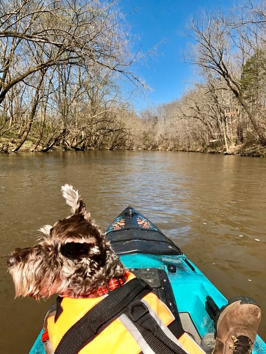
A confluence is a coming together or joining of two or more streams or rivers. Also known as a conflux, it refers either to the point where a tributary joins a larger river, (main stem), or where two streams meet to become the source of a river of a new name. As you can see here, the Barren Fork is a much smaller tributary to the Collins, and the Collins is a tributary to the Caney Fork which eventually empties into the Mississippi River. A tributary, sometimes also referred to as an affluent, is a stream or river that flows into a main stem (or parent) river or a lake. A tributary does not flow directly into a sea or an ocean. Tributaries and the main stem river serve to drain the surrounding drainage basin of its surface and groundwater, leading the water out into an ocean. The opposite of a tributary is a distributary, which is a river or stream that branches off from and flows away from the main stream. Distributaries are most often found in river deltas.
Erosion
Flowing water is a prominent part of the erosion process. During the erosion process, soil and other types of material are carried away from the land's surface. As a rule of thumb, potential for water erosion exists whenever the slope of the land is at least 2 percent. Sediment is the material that is broken down from large objects by long-term processes such as erosion and weathering. At a confluence like this one, the common current of the main stem can often change significantly due to the addition of the accompanying tributary. Deposition can result downstream in the form of islands and sandbars in sections of lower flow. There are three types of erosion that aid in making a river: headward, vertical, and lateral erosion. At its source, a river will exhibit headward erosion. This erosion makes a river longer and occurs at the point the water enters the valley head. Vertical erosion is responsible for making a river channel deeper. This type of erosion is typically seen in the upper stages of a river in the form of the v-shaped valleys created here. Lateral erosion is responsible for making a river wider and is typically seen in the middle and lower stages of a river. Vertical erosion tends to make the confluence shape into a V, or an extended Y shape. There are also four mains processes of erosion that occur in rivers: hydraulic action, abrasion, attrition, and corrosion. Hydraulic action is defined as the force of water eroding softer rock, often seen in areas of rapids. Abrasion (or corrasion) is defined as large pieces of bed load material wearing away the river bed and banks. Attrition is defined as the process in which the bed load when sediment particles apply force on the bed or themselves and break, making smaller and rounded particles. Finally, corrosion is defined as acidic water corroding or dissolving rock in the water.
Questions
Question 1: Based on what you see at the posted coordinates, which stream would be considered the main stem and which stream would be considered the tributary? Explain?
Question 2: What kind of sediment is found in this area? Based on the condition of the sediment, what kind of erosion process (or processes) is likely most evident in this area of the confluence?
Question 3: Based on the configuration of the main stem and the tributary, what kind of erosion has aided in making these rivers? Headward, vertical, or lateral erosion?
Please send the answers through the messaging system or through email. Good luck and have fun. Sources for Barren Fork and Collins River comes from Wikipedia.
| We have earned GSA's highest level: |
 |