How does an earthquake occur?
It occurs when two tectonic plates are moving towards one another. After enough tension is built up, one slips over the top if the other, releasing the tension.
Most of NZ’s South Island is on a plate called the Pacific plate. But the northern part of South Island (and all of North Island) sit on the Australian plate.
The Pacific plate is moving roughly west at about 40mm a year relative to the Australian plate, where the Pacific plate moves under the Australian plate.
The boundary between the two is exactly where the earthquake occurred.
The positive aspect of this tectonic movement is the creation of the New Zealand´s beautiful mountain ranges like the Southern Alps and Kaikoura Range.
The earthquake on 14th of November 2016 with a magnitude of 7.8 resulted in a coastal uplift and some vertical movement along the fault line (where the plates meet).
The earthquake started 2 minutes after midnight, rupturing the Conway and Leader fault lines, jumped to the Hundalee fault, went along the Uwerau and Fidget faults, up the Jordan Thrust and down the Papatea fault, located near the Kekerengu mountain range before running out to sea along the Needles fault line under the light of the full moon.
New Zealand´s geography changed in a matter of minutes.
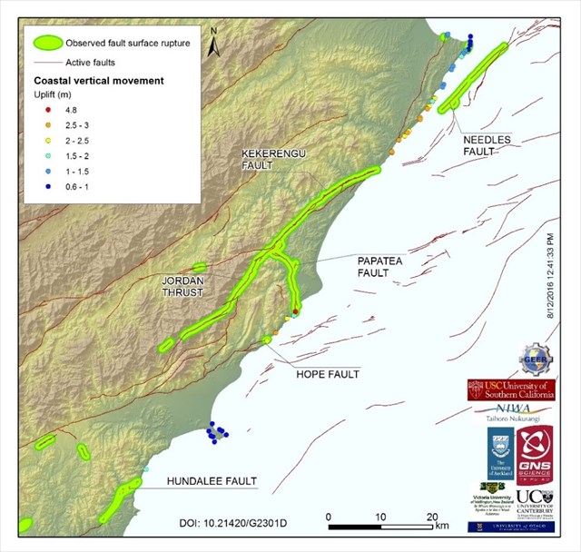
Coastal uplift began immediately north of where the Hundalee crosses the coastline at Oaro, near the Goose Bay, and reached up to 1.6 m.
Along a 120 km stretch of the Kaikoura coast, 80 km was lifted clear out of the water, permanently altering the shoreline and leaving sea creatures exposed.
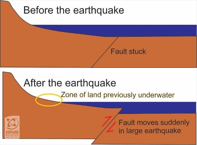
What is coastal uplift?
Coastal uplift is when the land is raised above the sea by tectonic forces. It can happen gradually over geological timescales or suddenly by an earthquake. When such vertical movement on a fault happens near the coast, the land is raised above sea level. Sea level is a powerful horizontal marker for measuring tectonic movement because it is very obvious which land used to be underwater before the earthquake.
(Source: GeoNet)
Tasks for this earth cache. Email me the answers to the following:
- Go to the given coordinates and describe the coastal landscape and how do you identify the uplift.
- Estimate the uplift around the Kaikoura Peninsula from GZ
- What can you see on the rocks, what you maybe couldn’t see before the earthquake?
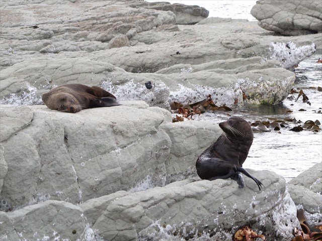
Enjoy a little walk around the Kaikoura Peninsula and say hello to our Bob at the seals colony.