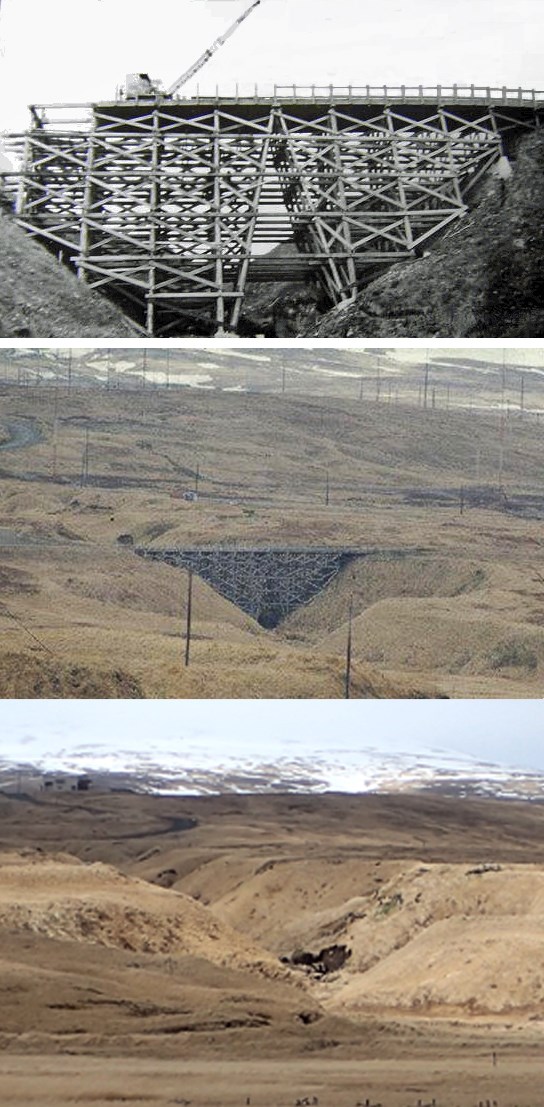
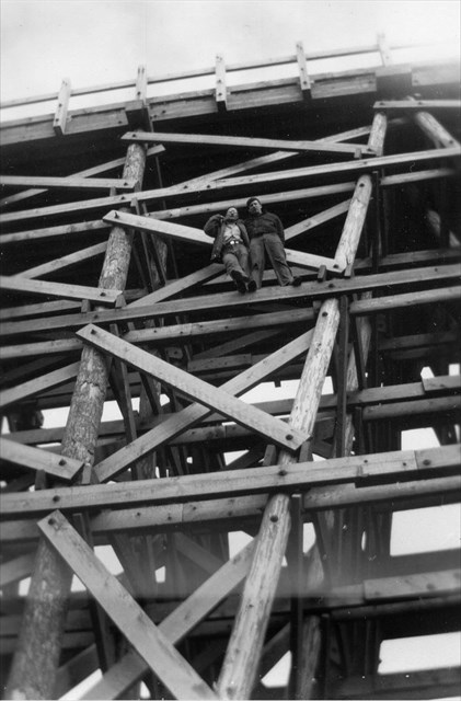
Toothpick Bridge was constructed during WWII, when within a few short, frenzied months the island of Adak went from being an uninhabited wilderness to a forward operating base for the Aleutian Campaign. The bridge remained in use throughout the Cold War but was eventually condemned, sometime in the 1980s. The photos at left, above, show the bridge being built in 1944, the way it looked from a distance--just like a bridge made of toothpicks--and the ravine today, with only a few scattered timbers and blocks to show where the bridge once stood. The photo at right, above, was taken by Fred Zalokoski or C.D. Schneider, soon after the bridge was built.
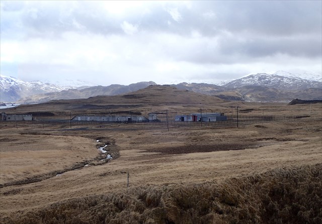
For many years the bridge was off limits, falling within the no-go zone around the MAUW Compound (MAUW = Modified Advanced Undersea Weapons, i.e. antisubmarine nuclear depth bombs), which was guarded by armed Marines and posted with signs warning "Use of Deadly Force Authorized." However, there were exceptions--one man remembers climbing on the bridge's supports with the Boy Scouts in the late 1960s, and damming the creek below the bridge to form a pool for a greased watermelon contest. And ghosts don't care about trespassing--a Marine on guard duty towards the end of the Cold War is said to have seen two lines of WWII-era Japanese soldiers marching all the way up to the bridge before fading away.
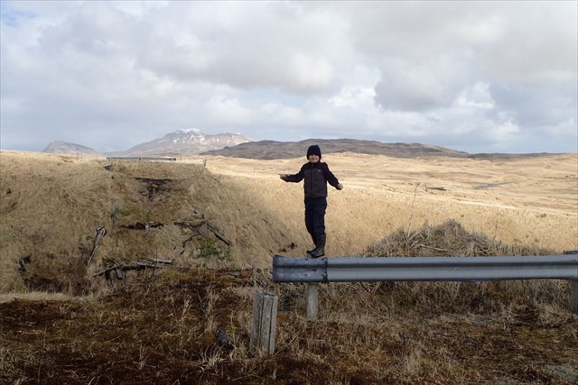
Nowadays anyone can visit what's left of the bridge. Guard rails block the remnants of road on either side of the ravine, and the tundra is gradually swallowing the last of the bridge's timbers. The north arm of Airport Creek chortles merrily at the bottom of the ravine, winding southeast to the MAUW Compound with its Seven Doors of Doom (photo below). On the flats to the east you can see the footprint of what was once a busy contractors camp, and the relatively new SuperDARN (Super Dual Auroral Radar Network) array. The hills to the southwest are in some years home to a shifting Aleutian tern colony.
This geocache is located on private land owned by The Aleut Corporation (TAC), and has been placed with TAC's explicit permission. Recreational use of TAC land requires a Land Use Permit, available for a nominal fee; use of TAC lands without a permit is considered trespass. You can obtain your land use permit upon arrival at the Pat Kelly Airport Terminal, the Aleut Real Estate office on Adak (592-2325) or at the City Office. Please respect TAC's gracious opening of their lands to public use by obtaining a permit and adhering to its conditions.