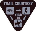
Most caches are close to the trail or road, at most, a dozen or two steps off. There are a number of points of interest to stop and take in the sights. If you use a bicycle, please remember to park your bike off of the trail or road.
This cache is located along M-185 that follows the shoreline.
I highly recommend to stop at the island's information booth at N45 50.971 W84 37.075 to get a map of the island. You can also download a copy by visiting the link below.
I have created a remote web page with general information for geocaching on Mackinac Island. Please visit this link for the latest info.
I read many of the logs that are posted on my caches, but sometimes I can't read all emails. If you find a problem with any of my caches, please post a "Needs Maintenance" log. Logs of that type are filtered into a special inbox that gets 100% read. Thank you.
For all of my caches placed within the Mackinac State Historical Parks managed areas, a permit has been filed and paid for each year.