Kanaka Creek
This part of Kanaka Creek Park is popular with locals and visitors alike.
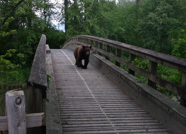
A 3-km-return, relatively flat loop trail takes you past Kanaka's oxbow and the Fraser River, and may include views of wildlife including coyotes and bears, so be careful.
Near the end of the trail, you can see, hiding behind the bushes, some long-forgotten fruit trees, a remnant of the homestead of Scotsman Samuel Robertson who planted here the first fruit-bearing orchard in all of British Columbia.
Sunsets in this park can be spectacular, but if you plan to visit this park towards the end of the day, take notice of the opening hours posted at the entrance of the parking lot. You don't want to be locked in!
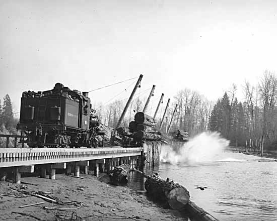
One of the big companies involved in the railway logging era was the Abernethy & Lougheed Logging Company near Haney (Maple Ridge). In the Kanaka Creek area, there was a bunkhouse, cookhouse and machine shop, employing 40 men.
The log dump was at mouth of Kanaka Creek where it joins the Fraser River. The railway went north to what is now the UBC Malcolm F. Knapp Research Forest.
The company finished its operations in Haney in 1928 and moved up the B.C. coast, only to go out of business soon after during the Great Depression. Remains of this railway can still be seen at the mouth of Kanaka Creek.
To find this geocache, visit stages 2, 3 and 4, and find the answers to a few questions which will give you the value of the letters in the final coordinates:
N49 12.ABC W122 35.DEF
Stage 2 - View on the Fort (Virtual Stage) N 49° 11.852 W 122° 34.980
Across the Fraser River from here was the original Fort Langley.
AB = the last two numbers of the year the first Fort Langley was established.
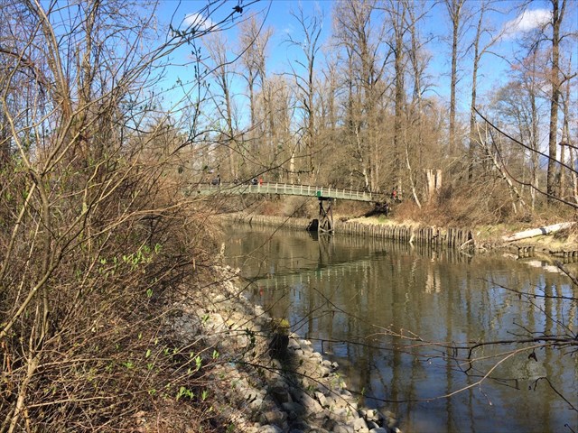
Stage 3 - Log Dump (Virtual Stage) N 49° 11.992 W 122° 35.111
This area is where the railroad ended and logs were dumped from the trains into the river.
C = Sticks and Booms: Employing up to how many people? Divide by 10.
D = Third digit of Abernethy & Lougheed's bankruptcy year.
E = Around what year was the "Booming Ground Crew" picture taken? Add the last two digits of the year for the answer.
Stage 4 - Kanaka (Virtual Stage) N 49° 11.998 W 122° 35.075
You're crossing the Kanaka Creek here. Any idea where the name Kanaka comes from?
F = The third number of the later of the two years listed.
Make your way to N49 12.ABC W122 35.DEF to find the geocache. Be careful! Bears use this area frequently. If you encounter a bear, give it a wide berth.