Machangding (馬場町) get its name because here used to be a training court of horses and cavalries in Japanese-colonized period. However in the White Terror period, this place became an execution ground. Many innocent people who was thought to be political prisoners was beheaded here. Nowadays, to achieve the goal of transilational justice, the Taipei city government renamed the reverside park to a memorial place. Here you will found a mound, and you might wonder how it formed and why the government wants to keep it. It is said that the executioner earthed previous victims blood before their next execution.
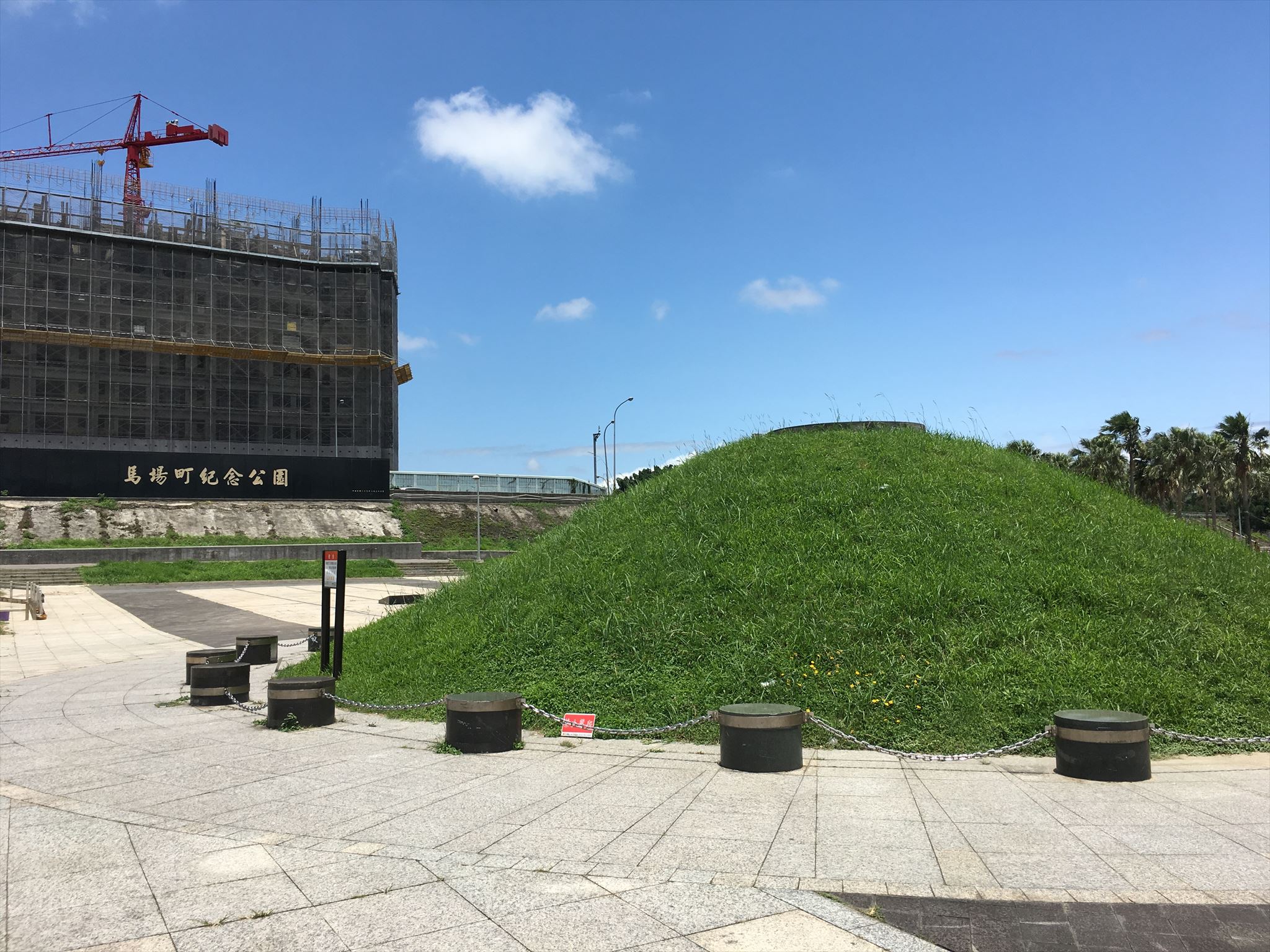
Step1: Please find this and count the number of chained black cylinders around the mound, which you will get the number XX.
Machangding used to link with the Youth park by an airport runway. The South Airport (南機場) has disappeared only the name left. Only few people knowed the stories of the name of this place, so we wrote it in the cache GC5QB8B. Here you can find a stone plane to memory the first Taiwan pilot along the bike trail.
 1945
1945

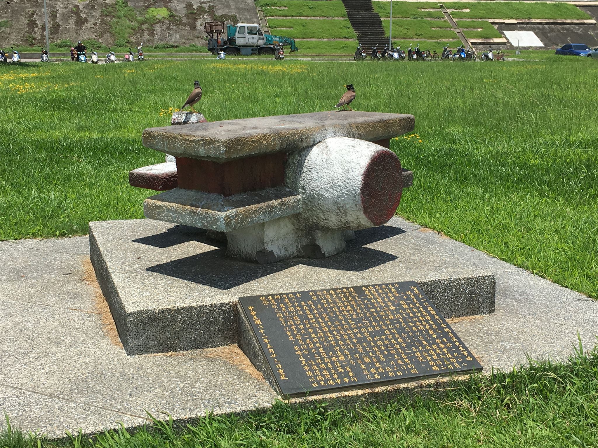
Step2: Find the stone plane nearby. In what year the first pilot in Taiwan deceased? You will get the answer, 19YY.
The final coordinates is
N25° 01.(160 + XX/2 - 12)
E121° 30.(283 + YY - XX/3)