Nearly all signs of the namesake of this park have long since disappeared, but the name Skunk Hollow lives on. The settlement of Skunk Hollow was established here after a fortuitous resource discovery in 1904. At the peak, about 75 people lived here in Skunk Hollow but after the two mines shut down in the 1920’s, the people left and the town was abandoned. Sometime after the settlement was gone, this area experienced new life as a popular campground. That too, was unfortunately not to last.
The date of the development of the campground near the old Skunk Hollow site is lost to history (but the good at folks at Mountain View County are trying to track that down) but the abrupt end is well documented, as you can see on the signs before you.
Question #1: Send the geocache owner (do NOT post in your online log) the exact date (day, month and year) of the flood that washed away the road, effectively cutting off campground from the outside world.
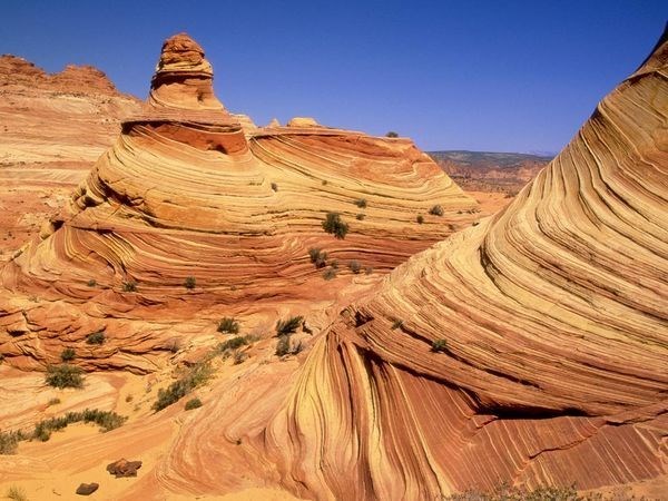
Here in the foothills of the Rocky Mountains, there has been a lot of folding of the rocks, meaning most of the time, the layers that were once laid down in a flat pancake style, have been pushed around. Where we are standing, the beds have been pushed so much they are nearly standing on end, creating this deep valley and the steep banks. One day, part of these steep banks of the valley gave way due to the process of erosion and forever changed this valley.

Figure 1 and Figure 2: Diagrams illustrate the idealized erosion of the area.
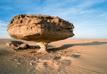
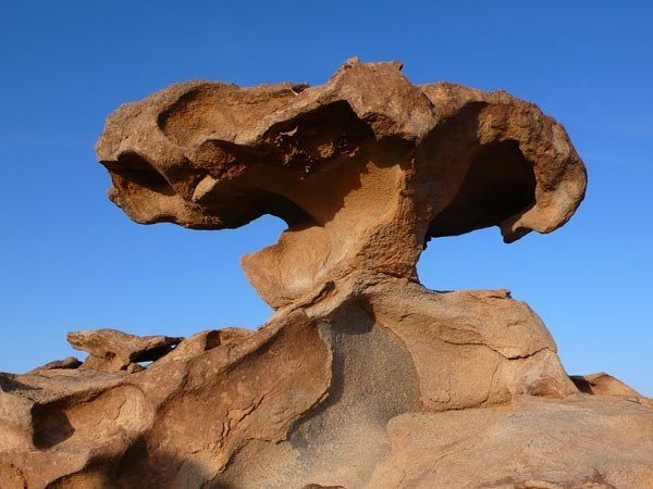
Erosion affects all sediments, but affects all sediments at different rates. When we can see this, it is called differential erosion. The harder, more resistant rocks remain to form ridges, hills or mountains whereas the softer rocks are more rapidly worn away, creating valleys and lakes. There is an excellent example of differential erosion just a little further (northeast) down the path. Eventually, the differential erosion will remove so much of a soft layer, the surrounding harder layers will collapse around it. It can happen a little at a time, or in a catastrophic event causing roads, houses or whole towns to be buried or washed away.
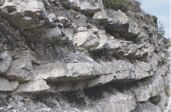
Figure 3: Looking up at the cliff, note the line of the surface has a pronounced V-shape to it because of the differential erosion of the rocks you see here.
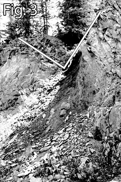
Question #2: In this example you see in front of you, the softest sediment (experiencing the most pronounced erosion) is what kind of rock? Send the geocache owner (do NOT post in your online log) the name of the type of rock.
Note: if you cannot identify it, send identifying information to the geocache owner including:
- Colour: What is the colour of the softest rock and the color of the surrounding harder rock?
- Luster: Does the softer rock look dull /dusty / powdery or does it look metallic or does it look shiny / sparkly in the sun? This is called the rock’s luster.
- Cleavage / Fracture: There is probably broken parts in the rock, does it break in sheets like a book or leaves or does it break in blocks like sugar cubes? This is called it’s cleavage or fracture.
We also use other things to identify rocks. Other common ones are hardness (but in this case, we already know it is softer than the surrounding rock) and streak (which is the color of the powdered form).
Question #3: What is the exact location (latitude and longitude) of the area you are standing to see the erosion example?
Plan Before You Go
This is a wilderness park in a no service zone. Be prepared before you come out here and be aware of:
- Bears and other wildlife inhabit this park. Please follow all the rules of the park and keep dogs on a leash, carry bear spray, do not discard trash except in the appropriate receptacles.
- This area has many ecologically sensitive areas. Please stay on the pathways.
- Have a GPS device and know how to take coordinates to answer the related question.
- Mark the location of your car before you enter the park and even take a photo of the map in the parking area.
- Make sure you understand the terrain and know your limits. The pathways are well maintained but it is a long climb back up.
Other Information
Mountain View County Parks
Mountain View Bear Smart
Alberta Bear Smart
Permission for this Earthcache granted prior to publication by the Mountain View County Manager Agricultural Services (the department responsible for Parks and Recreation within the county).
Differential Erosion Examples