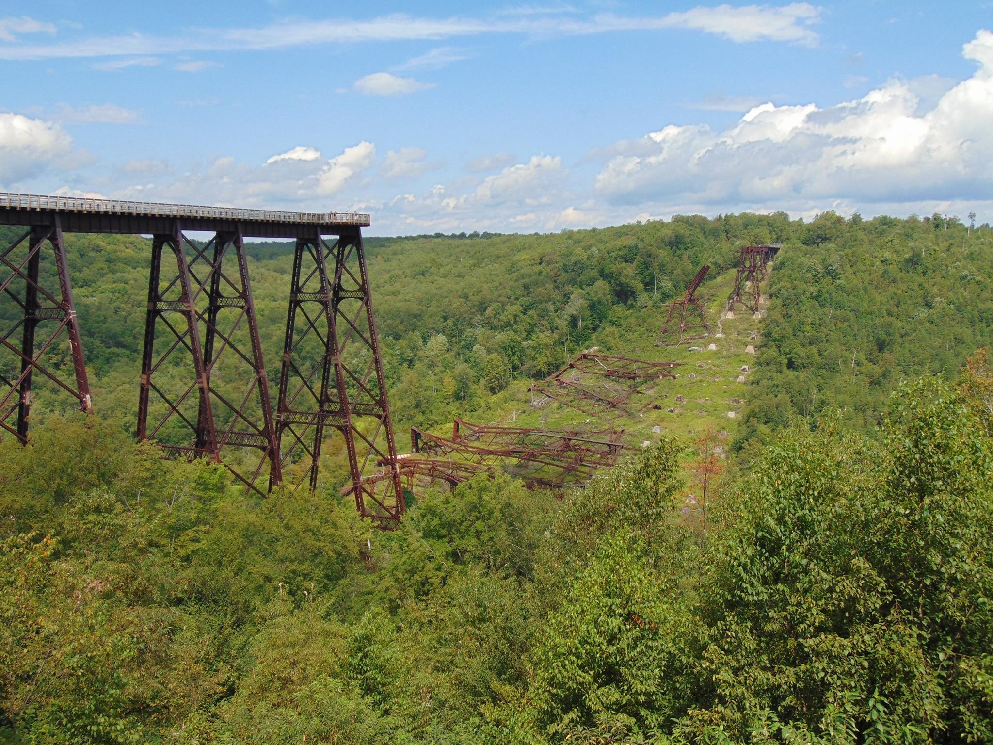
The Kinzua Viaduct was built in 1882 and was once known as the worlds longest and tallest railroad structure at 2053 feet long and 301 feet high, and was partially destroyed by a tornado in 2003. In 2011, the engineering masterpiece was reinvented as the Kinzua Bridge Skywalk, where visitors can walk out 600 feet on the remaining support towers, peer miles into the Kinzua Gorge, and look down through the partial glass platform at the end of the walkway.

The Kinzua Viaduct, spanning the Kinzua Valley, is located in the Allegheny Plateau. The Allegheny Plateau region of the eastern US stretches from the Mohawk Valley in New York State southward through parts of Pennsylvania, Ohio, Maryland, West Virginia and Virginia and extends for about 500 miles. The Allegheny Plateau was formed when sediments were deposited in a shallow inland sea over millions of years and were squeezed under millions of tons of pressure resulting in sandstone, silt, and shale. The valley floor and lower slopes are underlain by Mississippian- and Devonian-age sandstones and siltstones of the Shenango through Oswayo Formations. These rocks are overlain by sandstones and conglomerates of the Pennsylvanian-age Pottsville Formation, which forms the upper slopes and ridges.
The Allegheny Plateau was lifted when the Appalachian Mountains formed, and over the course of millions of years, streams and rivers eroded into the plateau cutting numerous hollows and valleys into it, which is why the Allegheny Plateau is considered a dissection plateau.
The Kinzua Viaduct, was first constructed in May 1882 was the highest and longest viaduct in the world. The need to transport coal, oil and lumber across the Kinzua Gorge inspired General Thomas Kane, president of the New York, Lake Erie and Western Coal Company and Octave Chanute, Chief Engineer for the Erie Railroad to design a colossal viaduct to cut 6 miles off of the route around the valley and increase profits. The viaduct was originally built from iron and in 1900, it was reconstructed from steel to accommodate heavier loads. Reconstruction was completed in 105 days by about 100 to 150 men working ten hours a day. The bridge stood for 121 years and the Erie Railroad operated trains across the viaduct from 1882 until 1959. After 28 years of inactivity, the Knox and Kane Railroad offered excursion passenger trains from Marienville (48 miles to the South by rail) to and across the bridge starting in 1987. These steam driven trains continued until 2002 and were the last trains to ever cross the bridge. In 2003, work was underway to restore the bridge, and on July 21, a light rain started to fall, and by 3:00 p.m. the crew repairing the viaduct had left the work site and returned to the construction compound located adjacent to the bridge. At approximately 3:20 pm, a F1 tornado (wind speeds between 73 and 112 mph) touched down and caused the collapse of 23 of the 41 spans and 11 of the support towers. In 2009, work began to reinvent the remaining towers as the Kinzua Sky Walk.
Logging Requirements
- From the Visitor's Center, proceed down the Kinzua Creek Trail to the foot bridge over Kinzua Creek (posted coordinates). Using a compass, measure the bearings of the orientation of the valley. Which way is the valley sloping down towards (think gravity, the stream (water) flows downhill)? Record your elevation at the footbridge.
- Proceed back up the Kinzua Creek Trail to the Kinzua Valley Overlook (waypoint provided), and record your elevation. Subtract the elevation you recorded by the creek to find the depth of the valley.
- Proceed to the end of the Kinzua Bridge Sky Walk (waypoint provided). The Sky Walk offers you a birds eye view of the valley. Observe the height of the hilltops around you, do they all appear to be roughly the same height? How does this support the fact that the region is a plateau?
- Upload a photo of the Kinzua Bridge, or any wildlife you saw while in the area.The photo must be taken near Kinzua Creek.
