This cache involves climbing the 303-step stairway to the viewing area at the top of Roche-a-Cri Mound within the RAC Mound State Natural Area. DO NOT MOVE BEYOND THE STAIRS OR THE VIEWING PLATFORM! Along the way and at the viewing platform you will read signs and make observations to gather information to determine where the actual cache is located, which can be found after you return to the parking area. Physical caches and waypoints are not allowed on SNA lands.
Roche-A-Cri Mound has always drawn human visitors, from the early unnamed inscribers of the petroglyphs at its base to today's campers, picnickers, outdoors enthusiasts, and climbers of the stairway. However, the mound itself and the ecosystem that it supports and that it is surrounded by are protected as one of Wisconsin's many state natural areas. Those who want to head up the stairs to get a closer look at the sandstone centerpiece of Roche-A-Cri State Park are restricted to the stairway and viewing platforms and are not allowed to venture beyond these structures. Those who choose to ignore the signs may find that the fines they receive are as steep as the climb!
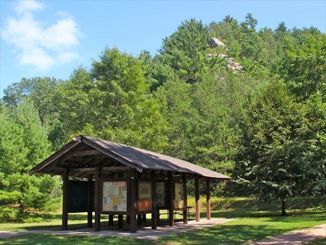
Once you arrive at the parking area, you may want to read the information at the kiosk and at the start of the stairway. Take your time on the strenuous climb up the stairs, and take advantage of the stopping areas along the way. Once you reach the top and walk out to the viewing platform, enjoy the views, but make sure to read the informational signs that are there. The following is what you need to learn to find the coordinates of the physical container that is the final of this field puzzle. If you want, you can print out the worksheet from the gallery below to take with you.
Questions to answer:
*** As you climb the stairs you will come to three landing areas where there are informative panels to read. You will need to answer one question for each panel as indicated below.
Q1 (A and B) — At the first panel (Welcome), fill in the blanks with two words and then count the letters of each word. “Roche-A-Cri Mound is one of over 300 Natural Areas that preserve native ________ and _________ communities. “ first word = A, second word = B
Q2 (C) — When you come to the panel at the next level (A Burning Need), fill in the blank and count the number of letters in that one word for C: “Without fire, ________ replaced grasslands.”
Q3 (D) — At the last panel that can be found not far from the top of the stairway, what is the title of the panel? Count the number of letters in the last word for D.
*** Once you walk out to the overlook area, you will see five informational panels. The answers to the remainder of the questions can be found on those panels.
Q4 (E) — On Panel 1, what feature is shown between Minnie Rock and Ship Rock? Count the number of letters in the second word of that feature to get E.
Q5 (F) — On Panel 2, what feature is shown to the left of Cottonville Rocks? Count the number of letters in the second word of that feature to get F.
Q6 (G) — On Panel 3, Which of the five identified rock outcroppings is the tallest? Count the number of letters in the first word of that feature to get G.
Q7 (H) — On Panel 4, count how many outcroppings are featured and use that number for H. (Only one name is partially obscured by the repair attempt.)
Q8 (J, K, L, M) — On the middle panel that features a map of “The Outliers of Glacial Lake Wisconsin”, identify the wedge of the map by the number shown for each of these four outliers: Rabbit Rock = J, Petenwell Rock = K, Dorro Couche Mound = L, Quincy Bluff = M.
In May of 2021 we were notified that the informational panel needed to get the values for Question 8 was damaged so we added a photo of that panel to the gallery on this cache page for you to use.
*** Now that you have identified numbers for each of the twelve letters, fill in those numbers for the letters in the coordinates below and do the simple math operations to get the coordinates for the location of the container for this SNA puzzle. You can check your answers for this puzzle on GeoChecker.com, or use the provided Solution Checker shown below.
N 44˚ 00.(E - A)(M - F)(D - K) W 089˚ 49.(B - C)(J + L)(H - G)
To go the the DNR State Natural Area page for RAC Mound, click on the 'Related Web Page' link at the top left of this cache page. An edited portion of the SNA description is as follows:
"Probably the most conspicuous and beautiful rock in Wisconsin is bold, irregular Roche-a-Cri, a late Cambrian sandstone outlier mesa of the retreating Magnesian Escarpment. Named by early French explorers, Roche-a-Cri or "crevice in the rock" refers to the large cleft in the rock structure that is visible from a distance. The distinctly shaped mound was once a rocky island in the former Glacial Lake Wisconsin and is long and narrow with a flat-topped ridge bordered by craggy, precipitous cliffs. The summit stands about 300 feet above the Central Sands plain and offers excellent views of several other late Cambrian sandstone crags and towers. Vegetation at the top of the mound consists of scattered red, black, and white oak with red, white, and jack pine. Plants characteristic of bracken grassland, sand barrens, cliff and dry forest, and prairie communities grow here too. Turkey vultures use the high mound as a roost site. Petroglyphs are present at the base of the mound. Roche-a-Cri is owned by the DNR and was designated a State Natural Area in 1983."
This cache is in Roche-A-Cri State Park. A current Wisconsin State Parks sticker (hourly, daily, or yearly) is required for all parked vehicles. The park is closed to non-campers from 11:00 p.m. to 6:00 a.m. Do not hunt for this cache during those hours.
The Geocache Notification Form has been submitted to and all necessary permissions have been received from Conservation Biologist Thomas Meyer, State Natural Area Program. Geocaches placed on Wisconsin Department of Natural Resource managed lands require permission by means of a notification form. Any cache involving a State Natural Area requires special permissions directly from Mr. Meyer. Please print out a paper copy of the notification form, fill in all required information, then submit it to the land manager. The DNR Notification form and land manager information can be obtained at DNR form 2500-118.
Special requirements for utilizing State Natural Area lands for virtual waypoints are outlined here:
Scroll down to the page for geocaching specific instructions.