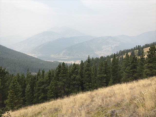
Smoky View from the Cache
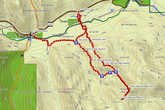
Parking for this cache and trail access depends on your goals for the day. If you are accessing this cache directly it is recommended to park at the refurbished Sentinel parking area (WP provided), ford the Highwood River there and pick up one of the river trails on the south side over to the trail junction point (WP provided). If you are planning to hike up to the South Highwood Ridge caches, you can park as far east as the suggested parking on CR's "A Knoll with a View" cache (WP provided). This requires a bushwhack down the river bank, river fording and gravel bed crossing. From there you could hike directly up the ridge (a bushwhack with no defined trail) to find the ridge caches and then descend in the meadow in the col before the summit (WP provided). Anywhere between the two parking areas will likely work as there are many trails (manmade and animal) that can be used to follow the south side of the river.
The direct hike to this cache from either parking would be roughly 3 km one-way with an elevation gain of just under 200m. If you are doing the loop from CR's parking spot, you are looking at a hike just over 10km with a net elevation gain of just under 600m. You are looking for a rectangular sandwich size LnL with pencils and logbook. Please replace and hide well.
Please be aware of the flow rate and depth of the river before attempting to ford it. The depth can vary as you cross. Poles are highly recommended. Do not attempt to ford during spring run-off. Use your best judgement and don't take chances.
As always, remember you are in the back country and come prepared for varied terrain, weather and possible animal encounters. Check avalanche conditions in the winter if necessary. Bear spray is strongly recommended. Let people know where you are going and if possible, try not to travel alone.
Track Log of Loop with Caches