Life’s a Beach #71 - South Shields (Sandhaven)
************************************************
If you would like to add more caches to this series, please feel free to do so!
Please contact heartradio through his profile first so that he can keep track of numbers and avoid duplications. Caches can be any type except Trads, so that cachers can see/learn more about the beach.
************************************************
Background
South Shields is situated in a peninsula setting, where the River Tyne meets the North Sea. It has six miles of coastline and three miles of river frontage, dominated by the massive North and South Piers at the mouth of the Tyne.
South Shields boasts extensive beaches, sand dunes and coves, as well as dramatic Magnesian Limestone cliffs with grassy areas above known as The Leas, which cover three miles of the coastline and are a National Trust protected area. Marsden Bay, with its famous Marsden Rock and historic nearby public house and restaurant set in the cliffs, is home to one of the largest seabird colonies in Britain.
Sandhaven Beach, known locally as the big beach, is much loved in the area by locals and each year people come from far and wide to play on the sand and in the sea. At the most northwesterly point of the beach sits the South Pier of the mouth of the River Tyne and in the south east sits the artillery gun at Trow Rocks. There are numerous restaurants, pubs and other eateries that line the beach as well as plenty car parks to accommodate the influx of visitors in the summer and the seafront complete with promenade, parks, fairground and amusement arcades, crazy golf, skate complex, 10 pin bowling, miniature steam railway and boating lake and live entertainment during the summer months.
Tourism is a key part of the local economy and where this brings in money to the local economy it also brings problems too. The sheer amount of visitors can have an adverse affect on the beach and in particular the sand dunes in the area which, in recent years, led to a breakdown of vegetation and destabilisation of the dunes. This therefore threatened the future of the foreshore as the dunes provide a vital coastal protection function and are a designated Local Wildlife Site. In 2012, with the assistance of the Environment Agency, South Tyneside Council started work on a £171,934 scheme to plant marram and lyme grass, grown in Norfolk, which was designed to bind the sand with root systems and stabilise the dunes. This work was successful and the dunes continue to thrive under careful management. Please respect the signage and fencing so that the dunes remain protected for future generations.
Cache
This cache is a multi, starting at the Northwesterly point of Sandhaven Beach where it meets the South Pier. The walk is around a mile taking you southeast towards Trow Rocks and its (replica) artillery piece. The path is a mixture of timber, concrete and tarmac, and is an enjoyable walk with lots of places either on the route or very nearby to stop for refreshments. The walk is fully dog friendly between October 1st and April 30th, and across the rest of the year only B is not accessible for furry friends so you could get A then bypass B using an alternative route to get C to F and use to checksum to get B ;) Just a quick note before you set off, if it's a warm day I can highly recommend the nearby ice cream sellers and on a colder day get chips….just follow your nose!
When you get to your final destination, and after signing the log, please take time to walk up onto Trow Rocks. There is a notice board on your way up to the gun for you to learn a bit more about it and there are other noticeboards nearby giving information on The Leas and the local wildlife. Much of this area is in a Site of Special Scientific Interest so make sure you treat the area with respect by following the footpaths where possible, taking heed of warning signage and, most of all, enjoying the amazing panoramic views of our beautiful coast.
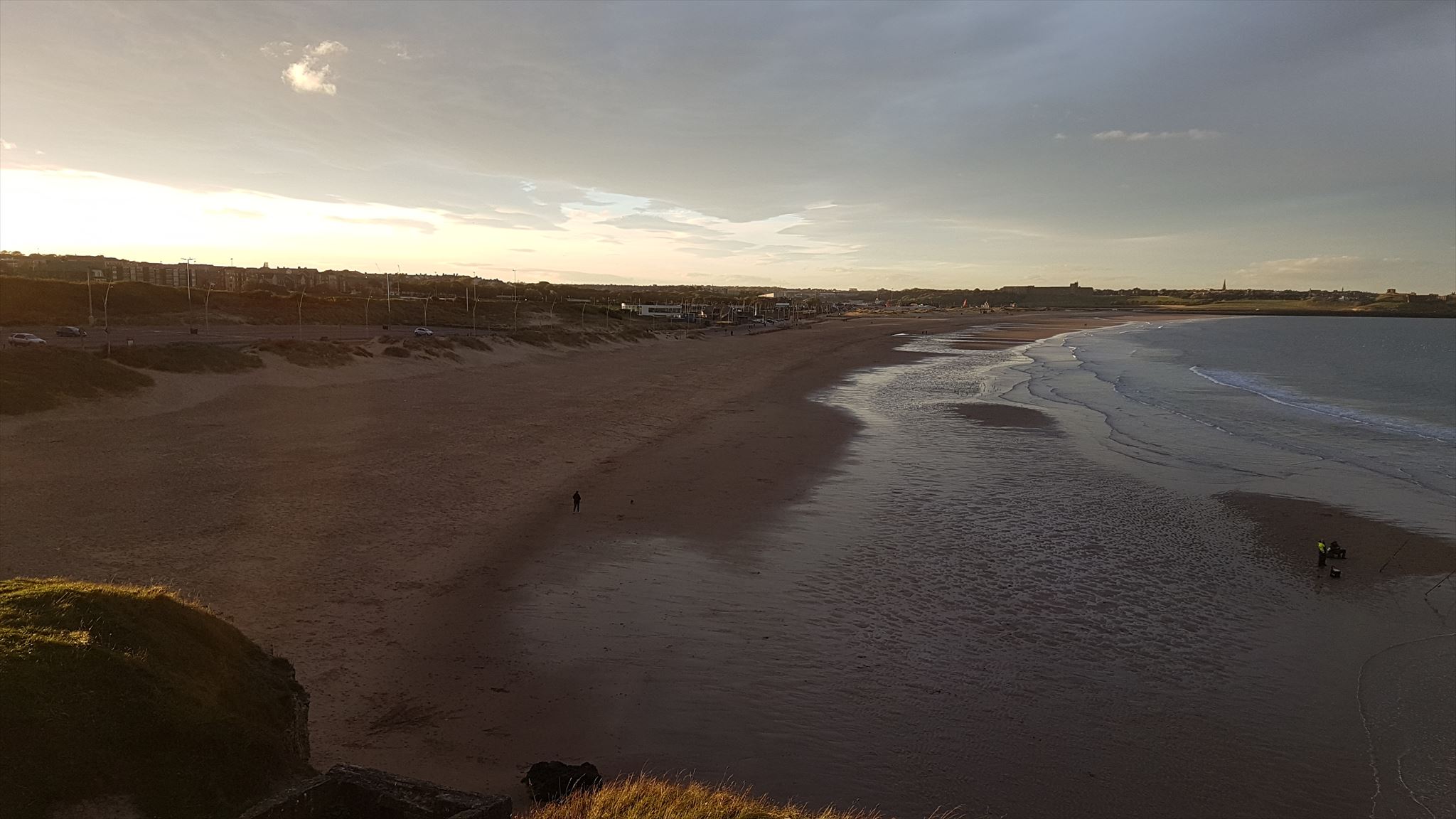
While I am not allowed to set a task of taking a photo as part of your visit for this cache, they would be most welcome in your logs if you would like to share them. Here is a photo looking North from our most recent visit while setting the cache;
Where is the cache!?
I have added all of the locations you need to head to get the required information as waypoints and the cache can be found at
N54 59.ABC W001 24.DEF Checksum = 27
In case anyone does what I do on multi's (copy the stuff I need into a notepad app) here are the instructions for each stage;
Stage 1 - A - On the charity walk related plaque in front of you, there are 13A miles from source to piers
Stage 2 - B - The number posts tall sign posts (not fence posts)
Stage 3 - C - On the Welcome to Sandhaven board you are looking for the number that follows STE in the top left. Once you have the number minus 2 from it
Stage 4 - D - The number of bike racks
Stage 5 - E - Find the seat dedicated to Shirley and you need the FIRST digit of the year of her death
Stage 6 - F - On the information board find the section 'out to sea’. F is the THIRD digit of the year the REPLICA gun was installed