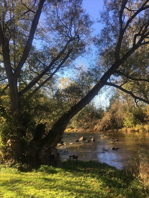
The Thames River at this location varies considerably in its depth, throughout the year. During the spring melt or after a day of rain, the depth is great and the flow rate is swift. During the summer and fall, the level drops considerably and the flow rate is low.
The dam that is a half kilometre to the north helps to regulate the flow of the river. This portion of the river is the Middle Branch of the Thames River. This portion joins the South Branch from Woodstock and Ingersoll a few kilometres south of here and then flows towards London. The river has eroded its way through the landscape here and produced evidence of it.
Erosion in rivers involves the wearing away of rock and soil found along the river bed and banks. Erosion also involves the breaking down of the rock particles being carried downstream by the river. The four main forms of river erosion are: Hydraulic action - the force of the river against the banks can cause air to be trapped in cracks and crevices. The pressure weakens the banks and gradually wears it away. Abrasion - rocks carried along by the river wear down the river bed and banks. Attrition - rocks being carried by the river smash together and break into smaller, smoother and rounder particles. Solution - soluble particles are dissolved into the river.
1. The flow rate of the river here can be estimated by multiplying the average depth and width of the river on the day you visit. Estimate the speed of flow of the water, by timing a floating twig or leaf over at least 10 metres distance along the river. Estimate the depth of the river and the width, and then calculate the flow rate in cubic metres per second.
The Thames River combines in London and flows westward to Lake St. Clair, where the discharge flow rate is monitored regularly by the conservation authorities. I looked it up online by searching "flow rates Thames River".
Compare your measurement of the flow rate here to the discharge flow rate at the mouth of the river. What percentage of the total flow at the mouth of the Thames River flows through this Middle Branch portion of the Thames River at Thamesford?
2. In the river at this location are signs of the erosion of the river channel, both in the river bottom, and along the sides of the river. If the water is shallow, you'll be able to see several examples. If it's deeper, you may notice only one or two. Take note of an example of erosion in this section of the river and classify it by one of the four types. What do you think will be the result of ongoing erosion of this type here?
Send your calculations and answers to me at norshley@gmail.com.
Take a scenic photo (optional) of your visit to the Thames River, with yourself or your GPSr in the photo if you wish, and post it with your log.