While visiting Crete the second time after 20 years this autumn we've also visitied Spinalonga peninsula as well as the small island Kalydon, which was a Venetian fortress island during 16th Century as well as one of Europe's last leper colonies until 1957.
The bigger of both islands - Spinalonga - is the target of this Earth Cache as we've found something very special here. We've climbed a lot of rocks on Crete, saw many different regions and walked many Kilometers at beach and rock areas at the coastal sides - but nowhere else we saw THIS.
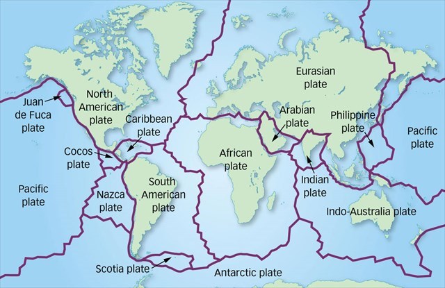
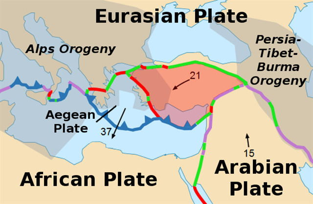
The island of Crete is - as well as the small islands closed to - near to a tectonic trench between the European plate going south and the African plate going north and under the European one.
![]()
![]()
This is the reason for the island landshifting in the region as well as for the high mountains of more that 2400 m on Crete. Through the period of Paleocene of the earths newer time the regoin of Crete as well as many other islands were part of the aegean continent. Today's shape accrued through tectonic activities in the pliocene and quaternary earth folding. These tectonical activities cut today's island in such a shape (long and thin island) off from aegean continent. Through miocene epoch the main part of Crete was under water, newer earthquakes and adjournments caused the bigger mountains and the lift-off of the landsdcape. In this time the landscape of Crete was formed, high mountains of about 2400 m, the mid-region of the complete island existing as mountainious Region which made Crete as typical as it is today.
![]()
There are several type of stones viewable in some regions; this occures from being parts of European and African tectonical plates which got several Stone types (volcanic and other sources as well).
Right here, directly at the coordinates, you can make out two different viewable type of stones. This is just because the plates are up and down and cut off something from each.
![]()
The tasks of this Cache got to do with the black granite and the brown limestone over here.
Granite is a heavy stone type that often consits sprinkles or thin veins of quarts as usual. Granite iscoming from the deep parts of the earth, around 2,000 m deep where pressure is high enough to harden the volcanic Stones. In several regions of the world it has totally different colors – starting with very lightend grey up to deepest black – with red, beige, blue and more color variations. Granite is a very hard stone type that was used during many periods for building and still today for nature-stoned floors.
Limestone is a sedimental stone that also got a wide variation of colors and forms and isn’t as hard as granite. It's being formed through biological ingredients. Many times it includes very well viewable fossil founds of shells, animals, corals and petriefied woods.
Having the water in the back you see the big black granite – nearly monochrome without quarts sprinkles as usual – as well as some brown limestone rocks. As we've walked around the whole island this seems to be something very special at this place - as it was not viewable anywhere else. The whole island got dark grey granite rocks that got the usual quarts sprinkles enclosed and the water line got this dark and monochrome black granite. There are also many limestones around but they're more lightened than the ones over here (shown in the background picture – a stone-figure that marks the paths over the island).
What to do to log this EC as a find??
1) first look at the big black granite rocks, describe structure and direction of the black part
2) now look at the biggest vein of quarts within the black rock, tell me the color of this part and also describe structure and direction of this and tell me the measurement of the thickness of the thickest one
3) at least look at the big brownish limestone rock next to the black one; describe structure and tell me something about the way it looks like (it has a very special kind of look-a-like and I will at least accept two different answers of what it looks like)
4) I would really love to see some pics of your visit of this place or even of any other place on that island - please be sure not to spoil the answers of that EC within your pictures!
Hope you're having fun and enjoy the time on that beautiful place on earth!!
Source Information:
Text excerpts from kreta.de and wikipedia.de
Images:
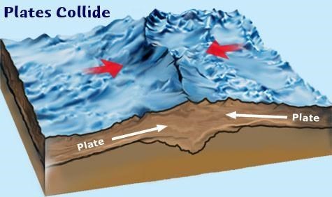
"Collision of plates" from divediscover.whoi.edu
"Eurasian - African Plate" from wikipedia.de
"Plates Worldwide" from intelligentanswers.co.uk
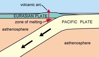
"Plates cut" from physicalgeography.net