Please see Trail Log for additional information.
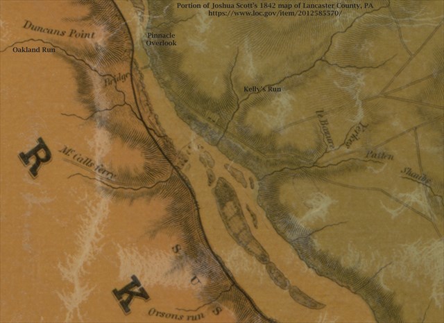
McCall's Ferry connected southern Lancaster and York counties. The Lancaster landing was roughly north of Kelly's Run. The York landing was roughly where McCall's Ferry Road intersects River Road today. For a while, there was also a bridge further up river just south of what is now Pinnacle Overlook on the Lancaster side and roughly where Oakland Run enters the Susquehanna on the York side. The York land extended further into what is now the water before the Holtwood Dam was built. The lake near that part of the York shore remains somewhat shallow today.
North 39 49.---
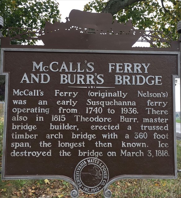
For how many years did McCall's Ferry operate?
136 - 850
196 - 881
204 - 775
225 - 903
West 76 20.---
The bridge was erected with the help of the ice. And the ice destroyed it. How many years did the bridge stand?
3 - 747
8 - 782
18 - 675
36 - 805