The cache is located at S33° 50.ABC E 151° 12.DEF.
Lavender Bay, now increasingly very prime real estate, was a working waterfront throughout much of the 20th century.
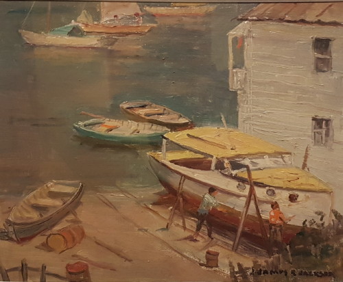
James Ranalph Jackson, 1882-1975
From the listed starting co-ordinates, this simple multi takes you on a short history tour of Sydney Harbour boatbuilding.
You can find the missing co ordinates by collecting information from five plaques, all located relatively close together.
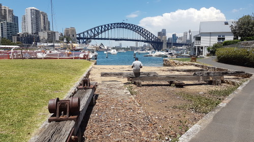
Bob Gordon Reserve
A - Between 1970 and 198A, Bob built fishing boats...
Waypoint 1
B - The pair of two storey sheds that survive today were erected as early as 19B5.
Along the foreshore
Three other plaques nearby will give you the remaining numbers
C - It was installed in the Government launch Calopus for use at Thursday Island in 193C.
[ The plaque at this waypoint has been stolen. C=0]
D - From the 1880s until at least the 19D0s, swimmers shared the waters..
E - The slipway cradle consisted of two flat wooden frames, E.1 metres long by 5.3 metres wide..
F - The cradle had F steel vertical side arms.
You can check your answers for this puzzle on GeoChecker.com.
No need to go into any private property.
*** FTF Honours go to Team Canary. Congratulations! ***